
Mapa topográfico Clear Lake
Mapa interactivo
Haga clic en el mapa para ver la altitud.
Acerca de este mapa
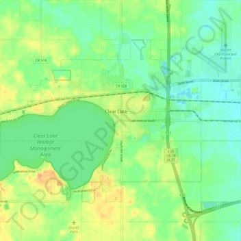
Nombre: Mapa topográfico Clear Lake, altitud, relieve.
Lugar: Clear Lake, Cerro Gordo County, Iowa, 50428, United States (43.10469 -93.43827 43.16273 -93.32001)
Altitud media: 373 m
Altitud mínima: 357 m
Altitud máxima: 398 m
Otros mapas topográficos
Haga clic en un mapa para ver su topografía, su altitud y su relieve.
Rockwell
United States > Iowa > Cerro Gordo County
Rockwell, Cerro Gordo County, Iowa, United States
Altitud media: 343 m
Mason City
United States > Iowa > Cerro Gordo County
Mason City, Cerro Gordo County, Iowa, United States
Altitud media: 352 m
Clear Lake
United States > Iowa > Cerro Gordo County > Clear Lake > Clear Lake
Clear Lake, Cerro Gordo County, Iowa, 50428, United States
Altitud media: 373 m