
Mapa topográfico Velká Deštná
Mapa interactivo
Haga clic en el mapa para ver la altitud.
Velká Deštná
Velká Deštná (German: Deschneyer Großkoppe) is a mountain in the Hradec Králové Region of the Czech Republic. With an elevation of 1,116 m (3,661 ft), it is the highest mountain of the Orlické Mountains and of the whole Central Sudetes range. There is an observation tower on top of the mountain, which is one of the most visited observation towers in the country
Acerca de este mapa
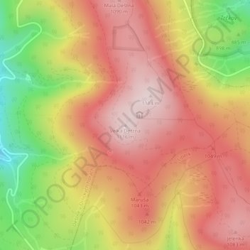
Nombre: Mapa topográfico Velká Deštná, altitud, relieve.
Altitud media: 962 m
Altitud mínima: 727 m
Altitud máxima: 1.112 m