
Mapa topográfico Freihalden
Mapa interactivo
Haga clic en el mapa para ver la altitud.
Acerca de este mapa
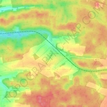
Nombre: Mapa topográfico Freihalden, altitud, relieve.
Altitud media: 518 m
Altitud mínima: 469 m
Altitud máxima: 550 m
Otros mapas topográficos
Haga clic en un mapa para ver su topografía, su altitud y su relieve.
Günzburg
Deutschland > Bayern > Landkreis Günzburg
Günzburg, Landkreis Günzburg, Bayern, 89312, Deutschland
Altitud media: 461 m