Mapa topográfico Adams
Haga clic en el mapa para ver la altitud.
Adams
The shield was derived from the Provincial Seal of Ilocos Norte. The mountain range and the verdant field and river show the topography of the place as a potential source of wealth and livelihood. The mountain ranges also symbolizes the lofty ideals and the high hopes of the people for making Adams a progressive and attractive place to live in.
Acerca de este mapa
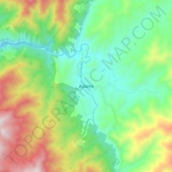
Nombre: Mapa topográfico Adams, altitud, relieve.
Lugar: Adams, Ilocos Norte, Ilocos Region, 2922, Philippines (18.42131 120.86357 18.50131 120.94357)
Altitud media: 517 m
Altitud mínima: 153 m
Altitud máxima: 1.185 m
Otros mapas topográficos
Haga clic en un mapa para ver su topografía, su altitud y su relieve.
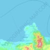
Pagudpud
The town's topography includes mountains, hills, valleys and flat coastal land.
Altitud media: 73 m



Pagudpud
The topography includes mountains, hills, valleys, and flat coastal land. Maira-ira Beach is the northernmost tip of Luzon Island, located at 18°33′34″N 120°47′15″E / 18.55944°N 120.78750°E / 18.55944; 120.78750 on the Luzon Strait.
Altitud media: 73 m

Pagudpud
The town's topography includes mountains, hills, valleys and flat coastal land.
Altitud media: 73 m