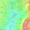
Mapa topográfico Linfen City
Haga clic en el mapa para ver la altitud.
Linfen City
Within its borders Linfen City has a variety of topographical features. It is characterised as having a "U" shape, with its mountains, covering 29.2% of the prefectural area, on all four cardinal directions, a basin, the Linfen Basin (临汾盆地), covering 19.4%, in the middle, and intervening hills, covering 51.4%, in between. In the east, from north to south, are Mount Huo (霍山) and the Zhongtiao Mountains; in the west are the Lüliang Mountains, with elevations mostly above 1,000 metres (3,300 ft). The highest point in the prefecture is the main peak of Mount Huo, at 2,347 metres (7,700 ft), and the lowest is in Xiangning County, at 385 metres (1,263 ft). Important rivers in the area include the Yellow, Fen, Xinshui (昕水河), Qin (沁河), Hui (浍河), E (鄂河), and Qingshui Rivers (清水河).
Acerca de este mapa

Nombre: Mapa topográfico Linfen City, altitud, relieve.
Lugar: Linfen City, Shanxi, China (35.38647 110.36911 36.94258 112.56760)
Altitud media: 989 m
Altitud mínima: 355 m
Altitud máxima: 2.541 m
Otros mapas topográficos
Haga clic en un mapa para ver su topografía, su altitud y su relieve.


Changzhi
China > Shanxi > Changzhi > Yingxiongnanlu Subdistrict
Changzhi is located in southeastern Shanxi province, along the southern section of the Taihang Mountains. The majority of the city's area is mountainous, and much of the remaining geography is hilly in nature. The average elevation in the city is approximately 1,000 metres (3,300 ft) above sea level, with…
Altitud media: 986 m






Huozhou
China > Shanxi > Huozhou City > Beihuanlu Subdistrict
The city's altitude ranges from 516 to 2,504.3 m (1,693 to 8,216 ft) in height. The Fen River runs through the city from north to south.
Altitud media: 908 m