
Mapa topográfico Randolph Township
Mapa interactivo
Haga clic en el mapa para ver la altitud.
Acerca de este mapa
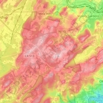
Nombre: Mapa topográfico Randolph Township, altitud, relieve.
Altitud media: 247 m
Altitud mínima: 97 m
Altitud máxima: 340 m
Otros mapas topográficos
Haga clic en un mapa para ver su topografía, su altitud y su relieve.
Chatham
United States > New Jersey > Morris County
Chatham, Morris County, New Jersey, United States
Altitud media: 76 m
Mount Olive
United States > New Jersey > Morris County
Mount Olive, Morris County, New Jersey, United States
Altitud media: 280 m
Montville Township
United States > New Jersey > Morris County > Montville Township
Montville Township, Morris County, New Jersey, United States
Altitud media: 115 m
Parsippany-Troy Hills
United States > New Jersey > Morris County
Parsippany-Troy Hills, Morris County, New Jersey, United States
Altitud media: 113 m
Rockaway
United States > New Jersey > Morris County
Rockaway, Morris County, New Jersey, United States
Altitud media: 196 m