
Mapa topográfico Spiekeroog
Mapa interactivo
Haga clic en el mapa para ver la altitud.
Acerca de este mapa
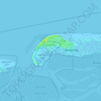
Nombre: Mapa topográfico Spiekeroog, altitud, relieve.
Lugar: Spiekeroog, Landkreis Wittmund, Lower Saxony, 26474, Germany (53.74969 7.66598 53.78232 7.81724)
Altitud media: 0 m
Altitud mínima: -2 m
Altitud máxima: 16 m
Otros mapas topográficos
Haga clic en un mapa para ver su topografía, su altitud y su relieve.
Wold
Germany > Lower Saxony > Landkreis Wittmund > Holtgast
Wold, Holtgast, Samtgemeinde Esens, Landkreis Wittmund, Lower Saxony, 26427, Germany
Altitud media: 2 m
Friedeburg
Germany > Lower Saxony > Landkreis Wittmund
Friedeburg, Landkreis Wittmund, Lower Saxony, 26446, Germany
Altitud media: 7 m
Esens
Germany > Lower Saxony > Landkreis Wittmund
Esens, Samtgemeinde Esens, Landkreis Wittmund, Lower Saxony, Germany
Altitud media: 1 m
Werdum
Germany > Lower Saxony > Landkreis Wittmund
Werdum, Samtgemeinde Esens, Landkreis Wittmund, Lower Saxony, Germany
Altitud media: -1 m
Spiekeroog
Germany > Lower Saxony > Landkreis Wittmund > Spiekeroog
Spiekeroog, Landkreis Wittmund, Lower Saxony, 26474, Germany
Altitud media: 0 m