
Mapa topográfico Cooke City-Silver Gate
Mapa interactivo
Haga clic en el mapa para ver la altitud.
Acerca de este mapa
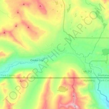
Nombre: Mapa topográfico Cooke City-Silver Gate, altitud, relieve.
Altitud media: 2.686 m
Altitud mínima: 2.166 m
Altitud máxima: 3.523 m
Cooke City-Silver Gate is a census-designated place (CDP) in Park County, Montana, United States. The population was 140 at the 2000 census. It sits toward the northeast of Yellowstone National Park on a road remaining open during the winter connecting through Tower Junction to Mammoth and north to Livingston, Montana. During the summer the road opens eastward to connect to Red Lodge, Montana via the Beartooth Highway on a scenic route climbing to 10,947 feet in elevation through the Beartooth Mountains and across the Beartooth Plateau. Its chief industry is tourism, which during the winter includes skiing and snowmobiling.