
Mapa topográfico Leam More
Mapa interactivo
Haga clic en el mapa para ver la altitud.
Acerca de este mapa
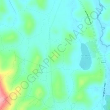
Nombre: Mapa topográfico Leam More, altitud, relieve.
Altitud media: 74 m
Altitud mínima: 45 m
Altitud máxima: 178 m
Otros mapas topográficos
Haga clic en un mapa para ver su topografía, su altitud y su relieve.
Trillick
United Kingdom > Northern Ireland > Letterbreen
Trillick, Letterbreen, County Fermanagh, Northern Ireland, United Kingdom
Altitud media: 75 m