
Mapa topográfico Kendrick
Mapa interactivo
Haga clic en el mapa para ver la altitud.
Acerca de este mapa
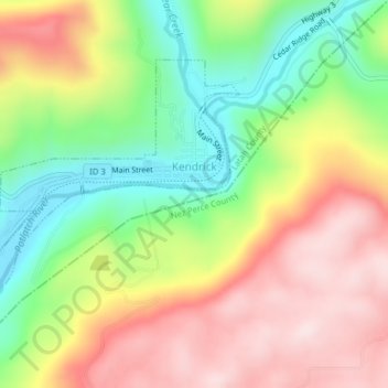
Nombre: Mapa topográfico Kendrick, altitud, relieve.
Altitud media: 559 m
Altitud mínima: 354 m
Altitud máxima: 773 m
Kendrick is located at 46°36′52″N 116°39′1″W / 46.61444°N 116.65028°W / 46.61444; -116.65028 (46.614321, -116.650354), near the Potlatch River. The elevation of the city is 1,240 feet (378 m) above sea level.