
Mapa topográfico Chief
Mapa interactivo
Haga clic en el mapa para ver la altitud.
Acerca de este mapa
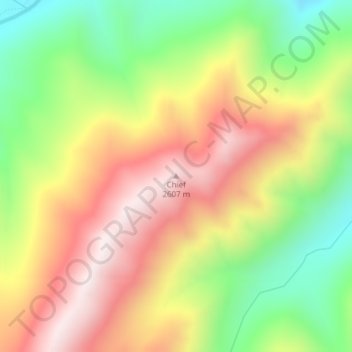
Nombre: Mapa topográfico Chief, altitud, relieve.
Lugar: Chief, Valley County, Idaho, United States (44.82474 -115.28214 44.82484 -115.28204)
Altitud media: 2.249 m
Altitud mínima: 1.872 m
Altitud máxima: 2.625 m
Otros mapas topográficos
Haga clic en un mapa para ver su topografía, su altitud y su relieve.
McCall
United States > Idaho > Valley County
McCall, Valley County, Idaho, 83638, United States
Altitud media: 1.546 m
Yellow Pine
United States > Idaho > Valley County
Yellow Pine, Valley County, Idaho, 83677, United States
Altitud media: 1.619 m
Buckhorn Summit
United States > Idaho > Valley County
Buckhorn Summit, Valley County, Idaho, United States
Altitud media: 2.294 m
Marsh Creek
United States > Idaho > Valley County
Marsh Creek, Valley County, Idaho, United States
Altitud media: 2.269 m