
Mapa topográfico Камчатка
Mapa interactivo
Haga clic en el mapa para ver la altitud.
Камчатка
Like most of its namesake peninsula, the basin of the Kamchatka River has at low altitudes a subarctic climate (Köppen Dfc) with short, cool to comfortable summers and freezing, snowy winters.
Acerca de este mapa
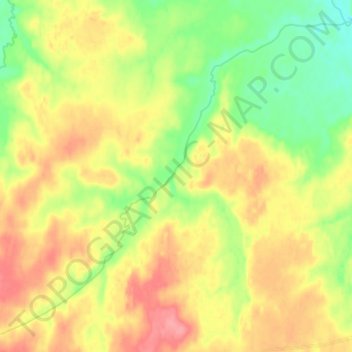
Nombre: Mapa topográfico Камчатка, altitud, relieve.
Altitud media: 180 m
Altitud mínima: 146 m
Altitud máxima: 215 m