
Mapa topográfico Lake Thunderbird
Mapa interactivo
Haga clic en el mapa para ver la altitud.
Acerca de este mapa
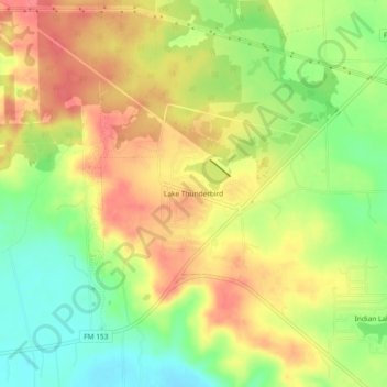
Nombre: Mapa topográfico Lake Thunderbird, altitud, relieve.
Lugar: Lake Thunderbird, Bastrop County, Texas, 78965, USA (30.03748 -97.13456 30.07748 -97.09456)
Altitud media: 124 m
Altitud mínima: 88 m
Altitud máxima: 154 m