

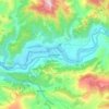
Mapa topográfico Srinagar Garwal
Haga clic en el mapa para ver la altitud.
Acerca de este mapa

Nombre: Mapa topográfico Srinagar Garwal, altitud, relieve.
Altitud media: 777 m
Altitud mínima: 511 m
Altitud máxima: 1.367 m
Otros mapas topográficos
Haga clic en un mapa para ver su topografía, su altitud y su relieve.

Srinagar
India > Uttarakhand > Srinagar
Srinagar is located at 30°13′N 78°47′E / 30.22°N 78.78°E / 30.22; 78.78. at the left bank of Alaknanda river. It has an average elevation of 560 metres (1,837 feet). It is the largest town in the Garhwal Hills. It is reached by national highway NH58 from Rishikesh, Srinagar is about 104 km…
Altitud media: 1.355 m
Srinagar
India > Uttarakhand > Srinagar
Srinagar is located at 30°13′N 78°47′E / 30.22°N 78.78°E / 30.22; 78.78. at the left bank of Alaknanda river. It has an average elevation of 560 metres (1,837 feet). It is the largest town in the Garhwal Hills. It is reached by national highway NH58 from Rishikesh, Srinagar is about 104 km…
Altitud media: 859 m