

Mapa topográfico Shaver Lake
Haga clic en el mapa para ver la altitud.
Shaver Lake
Shaver Lake (formerly Musick Creek and Musick Creek Heights) is a census-designated place (CDP) in Fresno County, California, United States. The population was 580 at the 2020 census, down from 634 at the 2010 census. Shaver Lake is on the southwest end of the lake of the same name, 10 miles (16 km) east of New Auberry, at an elevation of 5,627 ft (1,715 m). The name honors C.B. Shaver, founder of the Fresno Flume and Irrigation Company that built the dam, creating the lake. The lake served as a mill pond for the Shaver Sawmill and the source for a flume that ran 65 miles (105 km) to Clovis. The original town of Shaver was inundated when the Thomas A. Edison Company purchased and enlarged the lake in 1919.
Acerca de este mapa
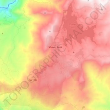
Nombre: Mapa topográfico Shaver Lake, altitud, relieve.
Altitud media: 1.437 m
Altitud mínima: 434 m
Altitud máxima: 2.096 m