
Mapa topográfico Aredale
Mapa interactivo
Haga clic en el mapa para ver la altitud.
Acerca de este mapa
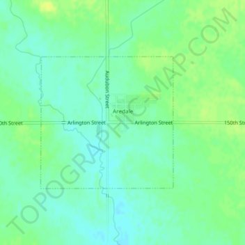
Nombre: Mapa topográfico Aredale, altitud, relieve.
Lugar: Aredale, Butler County, Iowa, United States (42.82594 -93.01548 42.84047 -92.99555)
Altitud media: 315 m
Altitud mínima: 307 m
Altitud máxima: 324 m
Otros mapas topográficos
Haga clic en un mapa para ver su topografía, su altitud y su relieve.
Parkersburg
United States > Iowa > Butler County
Parkersburg, Butler County, Iowa, United States
Altitud media: 295 m
Austinville
United States > Iowa > Butler County
Austinville, Butler County, Iowa, 50608, United States
Altitud media: 312 m
Greene
United States > Iowa > Butler County
Greene, Butler County, Iowa, United States
Altitud media: 301 m
Shell Rock
United States > Iowa > Butler County
Shell Rock, Butler County, Iowa, United States
Altitud media: 279 m
Aplington
United States > Iowa > Butler County
Aplington, Butler County, Iowa, United States
Altitud media: 302 m
Allison
United States > Iowa > Butler County
Allison, Butler County, Iowa, United States
Altitud media: 317 m
Kesley
United States > Iowa > Butler County
Kesley, Butler County, Iowa, 50649, United States
Altitud media: 305 m
Clarksville
United States > Iowa > Butler County
Clarksville, Butler County, Iowa, United States
Altitud media: 285 m
Dumont
United States > Iowa > Butler County
Dumont, Butler County, Iowa, United States
Altitud media: 301 m
New Hartford
United States > Iowa > Butler County
New Hartford, Butler County, Iowa, United States
Altitud media: 276 m
Bristow
United States > Iowa > Butler County
Bristow, Butler County, Iowa, United States
Altitud media: 312 m