
Mapa topográfico Three Holes
Haga clic en el mapa para ver la altitud.
Acerca de este mapa
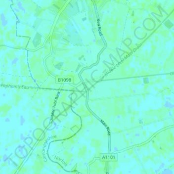
Nombre: Mapa topográfico Three Holes, altitud, relieve.
Altitud media: 2 m
Altitud mínima: -2 m
Altitud máxima: 6 m
Otros mapas topográficos
Haga clic en un mapa para ver su topografía, su altitud y su relieve.
Ringstead
United Kingdom > England > Norfolk > King's Lynn and West Norfolk > Ringstead
Altitud media: 37 m
Grimston
United Kingdom > England > Norfolk > King's Lynn and West Norfolk > Grimston
Altitud media: 30 m
Terrington St. Clement
United Kingdom > England > Norfolk > King's Lynn and West Norfolk
Altitud media: 2 m
Terrington St. John
United Kingdom > England > Norfolk > King's Lynn and West Norfolk
Altitud media: 2 m
Docking
United Kingdom > England > Norfolk > King's Lynn and West Norfolk
Docking village in the centre of the parish is situated at an elevation of 82.7 metres (272 feet), which makes it one of the highest in Norfolk. It is surrounded by arable farmland having little woodland and is a nucleated settlement, with only one historical hamlet associated with it. This is Summerfield to…
Altitud media: 63 m
Clenchwarton
United Kingdom > England > Norfolk > King's Lynn and West Norfolk > Clenchwarton
Altitud media: 3 m
Holme next the Sea
United Kingdom > England > Norfolk > King's Lynn and West Norfolk
Altitud media: 10 m
Tilney All Saints
United Kingdom > England > Norfolk > King's Lynn and West Norfolk
Altitud media: 3 m
Castle Rising
United Kingdom > England > Norfolk > King's Lynn and West Norfolk > Castle Rising
Altitud media: 22 m
West Winch
United Kingdom > England > Norfolk > King's Lynn and West Norfolk > West Winch
Altitud media: 7 m
Little Massingham
United Kingdom > England > Norfolk > King's Lynn and West Norfolk
Altitud media: 74 m
Syderstone
United Kingdom > England > Norfolk > King's Lynn and West Norfolk > Syderstone
Altitud media: 60 m
Hockwold cum Wilton
United Kingdom > England > Norfolk > King's Lynn and West Norfolk
Altitud media: 11 m
Tilney St. Lawrence
United Kingdom > England > Norfolk > King's Lynn and West Norfolk
Altitud media: 2 m
Great Massingham
United Kingdom > England > Norfolk > King's Lynn and West Norfolk
Altitud media: 79 m
Hunstanton Beach
United Kingdom > England > Norfolk > King's Lynn and West Norfolk > Hunstanton > Old Hunstanton
Altitud media: 10 m
Ely-Ouse-Essex Water Transfer Scheme
United Kingdom > England > Norfolk > King's Lynn and West Norfolk > Hockwold cum Wilton
Altitud media: 4 m
Northwold
United Kingdom > England > Norfolk > King's Lynn and West Norfolk > Northwold
Altitud media: 12 m
Sandringham Estate
United Kingdom > England > Norfolk > King's Lynn and West Norfolk > Sandringham
Altitud media: 25 m
Walpole Highway
United Kingdom > England > Norfolk > King's Lynn and West Norfolk > Walpole Highway
Altitud media: 2 m
Ryston
United Kingdom > England > Norfolk > King's Lynn and West Norfolk > Fordham
Altitud media: 15 m
Southery
United Kingdom > England > Norfolk > King's Lynn and West Norfolk > Southery
Altitud media: 0 m
Pur Fleet
United Kingdom > England > Norfolk > King's Lynn and West Norfolk > King's Lynn
Altitud media: 5 m
Wiggenhall St. Mary Magdalen
United Kingdom > England > Norfolk > King's Lynn and West Norfolk
Altitud media: 1 m
Saint Hilary Park
United Kingdom > England > Norfolk > King's Lynn and West Norfolk > King's Lynn
Altitud media: 7 m
Old Bedford River
United Kingdom > England > Norfolk > King's Lynn and West Norfolk
Altitud media: 1 m
Wiggenhall St. Germans
United Kingdom > England > Norfolk > King's Lynn and West Norfolk
Altitud media: 3 m
West Winch
United Kingdom > England > Norfolk > King's Lynn and West Norfolk > West Winch
Altitud media: 7 m
Walpole Highway
United Kingdom > England > Norfolk > King's Lynn and West Norfolk > Walpole Highway
Altitud media: 2 m
Docking
United Kingdom > England > Norfolk > King's Lynn and West Norfolk
Docking village in the centre of the parish is situated at an elevation of 82.7 metres (272 feet), which makes it one of the highest in Norfolk. It is surrounded by arable farmland having little woodland and is a nucleated settlement, with only one historical hamlet associated with it. This is Summerfield to…
Altitud media: 63 m
Great Massingham
United Kingdom > England > Norfolk > King's Lynn and West Norfolk
Altitud media: 79 m