
Haz una donación
Equípate para tu próxima aventura:
Como asociado de Amazon, este sitio gana comisiones por las compras que califican, sin ningún costo adicional para usted.
Mapa topográfico Rangeley
Haga clic en el mapa para ver la altitud.
Haz una donación
Equípate para tu próxima aventura:
Como asociado de Amazon, este sitio gana comisiones por las compras que califican, sin ningún costo adicional para usted.
Rangeley
This climatic region has large seasonal temperature differences, with warm (and often humid) summers and cold (sometimes severely cold) winters. According to the Köppen Climate Classification system, Rangeley has a humid continental climate, abbreviated "Dfb" on climate maps. Similar to the rest of New England, snowfall is high in Rangeley, but due to the cold mean temperatures in winter, it remains on the ground for several months. Summer temperatures are moderated by the elevation and are thus cooler than other nearby towns.
Haz una donación
Equípate para tu próxima aventura:
Como asociado de Amazon, este sitio gana comisiones por las compras que califican, sin ningún costo adicional para usted.
Acerca de este mapa
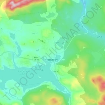
Nombre: Mapa topográfico Rangeley, altitud, relieve.
Lugar: Rangeley, Franklin County, Maine, United States (44.92166 -70.82363 45.03064 -70.62823)
Altitud media: 548 m
Altitud mínima: 421 m
Altitud máxima: 1.021 m
Haz una donación
Equípate para tu próxima aventura:
Como asociado de Amazon, este sitio gana comisiones por las compras que califican, sin ningún costo adicional para usted.
Otros mapas topográficos
Haga clic en un mapa para ver su topografía, su altitud y su relieve.
Haz una donación
Equípate para tu próxima aventura:
Como asociado de Amazon, este sitio gana comisiones por las compras que califican, sin ningún costo adicional para usted.