
Mapa topográfico Itajubá
Mapa interactivo
Haga clic en el mapa para ver la altitud.
Itajubá
Itajubá is a municipality in southeastern Minas Gerais state of the Federative Republic of Brazil. It lies in a valley by the Sapucaí river and has terrain elevations ranging from 827 to 1500 metres, occupying an area of 290.45 km2 (112.14 mi2), with a population of 97,334 people (2020 est). Neighboring the city are the mountain slopes of the Serra da Mantiqueira range. The climate sees heavy rain in the summer months with dry weather in the winter.
Acerca de este mapa
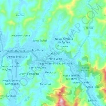
Nombre: Mapa topográfico Itajubá, altitud, relieve.
Altitud media: 923 m
Altitud mínima: 837 m
Altitud máxima: 1.378 m