

Mapa topográfico Santa Cruz
Haga clic en el mapa para ver la altitud.
Santa Cruz
Santa Cruz is traversed by mountain ranges and high relief that include part of Mount Apo, the highest mountain peak in the Philippines, straddle the south, central, north and north-western portions of the municipality. The rugged topography of the central area gradually undulates toward the coastal plains of the north-eastern, eastern and south-eastern parts. Here, settlements sprawl contiguously along the coast of Davao Gulf under the vast monotony of coconut plantations. On the western frontier, a plateau stretches toward Barangay Kapatagan of Digos City. The municipal elevation ranges from 10 to 2,939 metres (33 to 9,642 ft) above sea level (m.a.s.1.).
Acerca de este mapa
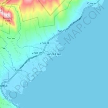
Nombre: Mapa topográfico Santa Cruz, altitud, relieve.
Lugar: Santa Cruz, Davao del Sur, Davao Region, Philippines (6.79406 125.37541 6.87406 125.45541)
Altitud media: 76 m
Altitud mínima: -5 m
Altitud máxima: 721 m