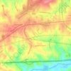
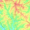
Mapa topográfico Long Island
Haga clic en el mapa para ver la altitud.
Acerca de este mapa

Nombre: Mapa topográfico Long Island, altitud, relieve.
Lugar: Long Island, Catawba County, North Carolina, United States (35.65791 -81.01341 35.69791 -80.97341)
Altitud media: 259 m
Altitud mínima: 228 m
Altitud máxima: 293 m
Otros mapas topográficos
Haga clic en un mapa para ver su topografía, su altitud y su relieve.
Hickory
United States > North Carolina > Catawba County
Lake Hickory was named after the City of Hickory and runs along its northern edge. The lake covers almost 4,223 acres (17.09 km2) with 105 miles (169 km) of shoreline. Full pond elevation is 935 feet (285 m). Lake Hickory is a reliable source of water for the Cities of Hickory and Conover and the Town of Long…
Altitud media: 317 m
Hickory
United States > North Carolina > Catawba County
Lake Hickory was named after the City of Hickory and runs along its northern edge. The lake covers almost 4,223 acres (17.09 km2) with 105 miles (169 km) of shoreline. Full pond elevation is 935 feet (285 m). Lake Hickory is a reliable source of water for the Cities of Hickory and Conover and the Town of Long…
Altitud media: 317 m

Sherrills Ford
United States > North Carolina > Catawba County
According to the United States Census Bureau, the CDP had a total area of 7.8 square miles (20 km2), 0.13% of which is water. It sits at an elevation of 204 m (670 ft).
Altitud media: 255 m



Hickory
United States > North Carolina > Catawba County
Lake Hickory was named after the City of Hickory and runs along its northern edge. The lake covers almost 4,223 acres (17.09 km2) with 105 miles (169 km) of shoreline. Full pond elevation is 935 feet (285 m). Lake Hickory is a reliable source of water for the Cities of Hickory and Conover and the Town of Long…
Altitud media: 317 m
Hickory
United States > North Carolina > Catawba County
Lake Hickory was named after the City of Hickory and runs along its northern edge. The lake covers almost 4,223 acres (17.09 km2) with 105 miles (169 km) of shoreline. Full pond elevation is 935 feet (285 m). Lake Hickory is a reliable source of water for the Cities of Hickory and Conover and the Town of Long…
Altitud media: 317 m
Hickory
United States > North Carolina > Catawba County
Lake Hickory was named after the City of Hickory and runs along its northern edge. The lake covers almost 4,223 acres (17.09 km2) with 105 miles (169 km) of shoreline. Full pond elevation is 935 feet (285 m). Lake Hickory is a reliable source of water for the Cities of Hickory and Conover and the Town of Long…
Altitud media: 317 m