
Mapa topográfico Sunshine Park
Mapa interactivo
Haga clic en el mapa para ver la altitud.
Acerca de este mapa
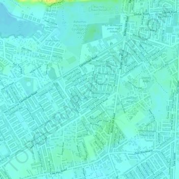
Nombre: Mapa topográfico Sunshine Park, altitud, relieve.
Lugar: Sunshine Park, New Providence, The Bahamas (25.02240 -77.36259 25.03030 -77.35214)
Altitud media: 7 m
Altitud mínima: 2 m
Altitud máxima: 26 m
Otros mapas topográficos
Haga clic en un mapa para ver su topografía, su altitud y su relieve.
Coconut Grove
The Bahamas > Coconut Grove > New Providence
Coconut Grove, New Providence, The Bahamas
Altitud media: 8 m
Imperial Park
Imperial Park, New Providence, The Bahamas
Altitud media: 6 m
Emerald Coast
Emerald Coast, New Providence, The Bahamas
Altitud media: 7 m