
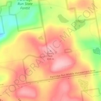
Mapa topográfico Henry Hill
Mapa interactivo
Haga clic en el mapa para ver la altitud.
Acerca de este mapa
Nombre: Mapa topográfico Henry Hill, altitud, relieve.
Altitud media: 600 m
Altitud mínima: 504 m
Altitud máxima: 657 m
Otros mapas topográficos
Haga clic en un mapa para ver su topografía, su altitud y su relieve.
Thompsons Lake
United States > New York > Albany County > Town of Berne
Thompsons Lake, Town of Berne, Albany County, New York, 12059, United States
Altitud media: 408 m
East Berne
United States > New York > Albany County > Town of Berne
East Berne, Town of Berne, Albany County, New York, 12059, United States
Altitud media: 410 m
Reidsville
United States > New York > Albany County > Town of Berne
Reidsville, Town of Berne, Albany County, New York, United States
Altitud media: 431 m
South Berne
United States > New York > Albany County > Town of Berne
South Berne, Town of Berne, Albany County, New York, United States
Altitud media: 445 m