
Mapa topográfico Tynda
Mapa interactivo
Haga clic en el mapa para ver la altitud.
Tynda
The town is located at an elevation of 500 meters (1,600 ft) above sea level, near where the Getkan joins the Tynda River, after which the town was named. The Tynda then flows into the Gilyuy, a tributary of the Zeya, a few kilometers east of the town.
Acerca de este mapa
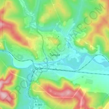
Nombre: Mapa topográfico Tynda, altitud, relieve.
Altitud media: 566 m
Altitud mínima: 477 m
Altitud máxima: 766 m