

Mapa topográfico Exeter
Haga clic en el mapa para ver la altitud.
Exeter
The city of Exeter was established on the eastern bank of the River Exe on a ridge of land backed by a steep hill. It is at this point that the Exe, having just been joined by the River Creedy, opens onto a wide flood plain and estuary which results in quite common flooding. Historically this was the lowest bridging point of the River Exe which was tidal and navigable up to the city until the construction of weirs later in its history. This combined with the easily defensible higher ground of the ridge made the current location of the city a natural choice for settlement and trade. In George Oliver's The History of the City of Exeter, it is noted that the most likely reasons for the original settling of what would become modern Exeter was the "fertility of the surrounding countryside" and the area's "beautiful and commanding elevation its rapid and navigable river". Its woodland would also have been ideal for natural resources and hunting.
Acerca de este mapa
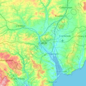
Nombre: Mapa topográfico Exeter, altitud, relieve.
Altitud media: 99 m
Altitud mínima: -10 m
Altitud máxima: 471 m
Otros mapas topográficos
Haga clic en un mapa para ver su topografía, su altitud y su relieve.
