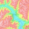
Mapa topográfico Shuanghu County
Haga clic en el mapa para ver la altitud.
Shuanghu County
Shuanghu County (Chinese: 双湖县), also transliterated from Tibetan as Tsonyi County or Co Nyi County (Tibetan: མཚོ་གཉིས་རྫོང་།), is a county under the jurisdiction of the prefecture-level city of Nagqu, in the northernmost part of the Tibet Autonomous Region, China. It was formed in 2012, combining the territory of the former Shuanghu Special District (Chinese: 双湖特别区, Tibetan: མཚོ་གཉིས་དམིགས་བསལ་སྲིད་འཛིན་ཁུལ་) with the eastern half of Nyima County. Much of the county is within the Changtang area. Shuanghu is the highest county of China with an average elevation of more than 5,000 metres (16,000 ft), while its county seat is located at 4,920 metres (16,140 ft).
Acerca de este mapa

Nombre: Mapa topográfico Shuanghu County, altitud, relieve.
Lugar: Shuanghu County, Nagqu City, Xizang, China (31.64274 86.06724 36.48407 90.37519)
Altitud media: 5.015 m
Altitud mínima: 4.465 m
Altitud máxima: 6.544 m
Otros mapas topográficos
Haga clic en un mapa para ver su topografía, su altitud y su relieve.

Mount Kailash
China > Xizang > Purang County > Parga town
Mount Kailash (also Kailasa; Kangrinboqê or Gang Rinpoche; Tibetan: གངས་རིན་པོ་ཆེ; simplified Chinese: 冈仁波齐峰; traditional Chinese: 岡仁波齊峰; Sanskrit: कैलास, IAST: Kailāsa), is a mountain in the Ngari Prefecture, Tibet Autonomous Region of China. It has an…
Altitud media: 5.756 m