
Mapa topográfico Snowdon
Mapa interactivo
Haga clic en el mapa para ver la altitud.
Acerca de este mapa
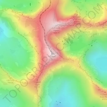
Nombre: Mapa topográfico Snowdon, altitud, relieve.
Altitud media: 692 m
Altitud mínima: 390 m
Altitud máxima: 1.061 m
Snowdon (/ˈsnoʊdən/; Welsh: Yr Wyddfa, pronounced ) is the highest mountain in Wales, at an elevation of 1,085 metres (3,560 ft) above sea level, and the highest point in the British Isles outside the Scottish Highlands. It is located in Snowdonia National Park (Parc Cenedlaethol Eryri) in Gwynedd (historic county of Caernarfonshire). It is the busiest mountain in the United Kingdom and the third most visited attraction in Wales; in 2019 it was visited by 590,984 walkers, with an additional 140,000 people taking the train. It is designated as a national nature reserve for its rare flora and fauna.