

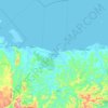
Mapa topográfico Lawaan
Haga clic en el mapa para ver la altitud.
Acerca de este mapa

Nombre: Mapa topográfico Lawaan, altitud, relieve.
Lugar: Lawaan, Northern Samar, Eastern Visayas, Philippines (12.50518 124.99489 12.54518 125.03489)
Altitud media: 6 m
Altitud mínima: -2 m
Altitud máxima: 61 m
Otros mapas topográficos
Haga clic en un mapa para ver su topografía, su altitud y su relieve.



San Antonio
The highest point of the island is in its central southern portion with a maximum elevation of 35 meters (115 ft) above sea level.
Altitud media: 56 m


