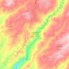
Mapa topográfico Forest Meadows
Haga clic en el mapa para ver la altitud.
Acerca de este mapa
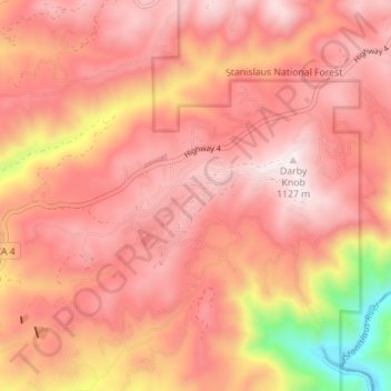
Nombre: Mapa topográfico Forest Meadows, altitud, relieve.
Altitud media: 886 m
Altitud mínima: 333 m
Altitud máxima: 1.127 m
Otros mapas topográficos
Haga clic en un mapa para ver su topografía, su altitud y su relieve.


Murphys
United States > California > Calaveras County
"MURPHY'S CAMP is a curious old mining-town in Calaveras County, at an elevation of 2,400 feet (730 m) above the sea, situated like a nest in the center of a rough, gravelly region, rich in gold. Granites, slates, lavas, limestone, iron ores, quartz veins, auriferous gravels, remnants of dead fire-rivers and…
Altitud media: 702 m
Angels
United States > California > Calaveras County
Angels Camp, also known as City of Angels and formerly Angel's Camp, Angels, Angels City, Carson's Creek and Clearlake, is the only incorporated city in Calaveras County, California, United States. The population was 3,836 at the 2010 census, up from 3,004 at the 2000 census. It lies at an elevation of 1378…
Altitud media: 459 m

Murphys
United States > California > Calaveras County > Murphys
"MURPHY'S CAMP is a curious old mining-town in Calaveras County, at an elevation of 2,400 feet (730 m) above the sea, situated like a nest in the center of a rough, gravelly region, rich in gold. Granites, slates, lavas, limestone, iron ores, quartz veins, auriferous gravels, remnants of dead fire-rivers and…
Altitud media: 717 m



Mountain Ranch Subdivision
United States > California > Calaveras County > San Andreas
Altitud media: 419 m
Murphys
United States > California > Calaveras County > Murphys
MURPHY'S CAMP is a curious old mining-town in Calaveras County, at an elevation of 2,400 feet (730 m) above the sea, situated like a nest in the center of a rough, gravelly region, rich in gold. Granites, slates, lavas, limestone, iron ores, quartz veins, auriferous gravels, remnants of dead fire-rivers and…
Altitud media: 717 m

Paloma
United States > California > Calaveras County > Paloma
Paloma (Spanish for "dove"; formerly, Fosteria and Frenchman's Ranch) is an unincorporated community in Calaveras County, California. It lies at an elevation of 1362 feet (415 m) and is located at 38°15′34″N 120°45′48″W / 38.25944°N 120.76333°W / 38.25944; -120.76333. The community is in…
Altitud media: 418 m
Angels Camp
United States > California > Calaveras County
Angels Camp, also known as City of Angels and formerly Angel's Camp, Angels, Angels City, Carson's Creek and Clearlake, is the only incorporated city in Calaveras County, California, United States. The population was 3,836 at the 2010 census, up from 3,004 at the 2000 census. It lies at an elevation of 1378…
Altitud media: 461 m


Dorrington
United States > California > Calaveras County
According to the United States Census Bureau, the CDP has a total area of 4.1 square miles (11 km2), 99.88% of it land. The elevation is 4,800 feet ASL.
Altitud media: 1.466 m
Angels
United States > California > Calaveras County
Angels Camp (formerly Angel's Camp, Angels, Angels City, Carson's Creek and Clearlake), is the only incorporated city in Calaveras County, California, United States. The population was 3,667 at the 2020 census. It lies at an elevation of 1381 feet (421 m).
Altitud media: 459 m



Blue Lake Springs
United States > California > Calaveras County > Blue Lake Springs
Altitud media: 1.312 m