
Mapa topográfico Col du Lautaret
Mapa interactivo
Haga clic en el mapa para ver la altitud.
Acerca de este mapa
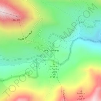
Nombre: Mapa topográfico Col du Lautaret, altitud, relieve.
Altitud media: 2.261 m
Altitud mínima: 1.804 m
Altitud máxima: 3.117 m
From the west, the climb starts at Les Clapier, near Le Bourg-d'Oisans, from where the climb is 34.2 km (21.3 mi) long, gaining 1,312 m (4,304 ft) in altitude, at an average gradient of 3.8%, with the steepest section being at 7.5% in the first kilometre.