
Mapa topográfico Cookley
Haga clic en el mapa para ver la altitud.
Acerca de este mapa
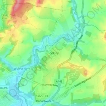
Nombre: Mapa topográfico Cookley, altitud, relieve.
Altitud media: 70 m
Altitud mínima: 35 m
Altitud máxima: 137 m
Otros mapas topográficos
Haga clic en un mapa para ver su topografía, su altitud y su relieve.
Stourport Historic Canal Basins
United Kingdom > England > Worcestershire > Wyre Forest > Stourport-on-Severn > Wilden
Altitud media: 33 m
River Severn
United Kingdom > England > Worcestershire > Wyre Forest > Stourport-on-Severn
Altitud media: 45 m