
Mapa topográfico Jaun
Mapa interactivo
Haga clic en el mapa para ver la altitud.
Acerca de este mapa
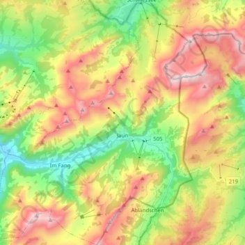
Nombre: Mapa topográfico Jaun, altitud, relieve.
Lugar: Jaun, Greyerzbezirk, Freiburg, 1656, Schweiz (46.56340 7.19399 46.67004 7.32070)
Altitud media: 1.487 m
Altitud mínima: 885 m
Altitud máxima: 2.218 m
Otros mapas topográficos
Haga clic en un mapa para ver su topografía, su altitud y su relieve.
Wüppingen
Schweiz > Freiburg > Greyerzbezirk
Wüppingen, Marsing, Greyerzbezirk, Freiburg, 1633, Schweiz
Altitud media: 744 m
Le Moléson
Schweiz > Freiburg > Greyerzbezirk > Gruyères
Le Moléson, Gruyères, Greyerzbezirk, Freiburg, 1663, Schweiz
Altitud media: 1.503 m