

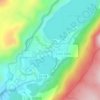
Mapa topográfico June Lake
Haga clic en el mapa para ver la altitud.
June Lake
Because the community is built on hills and meadows in this subalpine valley surrounded by high mountain peaks, it has been dubbed the "Switzerland of California." The area is notable for its trout fishing. Hiking is a favorite pastime of the area: June Lake offers many trails that lead into the nearby back country of the Ansel Adams Wilderness Area. Most of the hikes, including Fern Lake, Reversed Peak, and Agnew Lake are strenuous and vertical, with the exception of the Parker Lake Trail which is a 2-mile hike that only climbs 400 feet in elevation. The Frontier Pack Train at Silver Lake offers equestrian day rides, as well as backcountry trips. In Autumn, an abundance of aspen groves change from green to gold and red hues as winter approaches.
Acerca de este mapa

Nombre: Mapa topográfico June Lake, altitud, relieve.
Lugar: June Lake, Mono County, California, 93529, United States (37.73435 -119.13612 37.84283 -119.05380)
Altitud media: 2.531 m
Altitud mínima: 2.171 m
Altitud máxima: 3.337 m
Otros mapas topográficos
Haga clic en un mapa para ver su topografía, su altitud y su relieve.
June Lake
United States > California > Mono County > June Lake
June Lake is a census-designated place in Mono County, California. It is located against the southern rim of the Mono Basin, 12.5 miles (20 km) south of Lee Vining, at an elevation of 7654 feet (2333 m).
Altitud media: 2.445 m