Geolocalizar

Mapa topográfico Mauern

Haga clic en el mapa para ver la altitud.

Acerca de este mapa

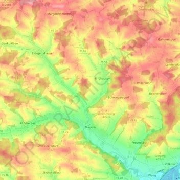
Nombre: Mapa topográfico Mauern, altitud, relieve.

Lugar: Mauern, Mauern (VGem), Landkreis Freising, Bayern, 85419, Deutschland (48.49336 11.85292 48.57107 11.94532)

Altitud media: 474 m

Altitud mínima: 403 m

Altitud máxima: 527 m

👉 Easily get elevation data in JSON, GeoTIFF and KML formats using Elevation API
Gracias por apoyar a este sitio ❤️
Haz una donación

Equípate para tu próxima aventura:

Como asociado de Amazon, este sitio gana comisiones por las compras que califican, sin ningún costo adicional para usted.

Otros mapas topográficos

Haga clic en un mapa para ver su topografía, su altitud y su relieve.

Flitzing

Deutschland > Bayern > Landkreis Freising

Altitud media: 462 m

Aich

Deutschland > Bayern > Landkreis Freising > Moosburg

Altitud media: 422 m

Inkofen

Deutschland > Bayern > Landkreis Freising

Altitud media: 440 m

Seysdorf

Deutschland > Bayern > Landkreis Freising

Altitud media: 480 m

Espe

Deutschland > Bayern > Landkreis Freising > Freising

Altitud media: 474 m

Thann

Deutschland > Bayern > Landkreis Freising

Altitud media: 469 m

Schlipps

Deutschland > Bayern > Landkreis Freising

Altitud media: 476 m

Kammerberg

Deutschland > Bayern > Landkreis Freising

Das „Bürger Windrad Kammerberg“ ist ein Windrad vom Typ Enercon E-115 mit 149 Meter Nabenhöhe und einer Gesamthöhe von 207 Meter. Es wird betrieben von der Bürger Energie Genossenschaft – Freisinger Land eG. Es gibt noch Pläne für weitere Windräderturme zu bauen.

Altitud media: 485 m

Troll

Deutschland > Bayern > Landkreis Freising > Moosburg

Auf alten topografischen Karten von 1890 befindet sich die Bezeichnung „Trollmühle“, die 1943 durch „Troll“ ersetzt wurde. Bis zum 1. Januar 1978 war Troll ein Ortsteil von Pfrombach, das dann nach Moosburg eingemeindet wurde.

Altitud media: 425 m

Weng

Deutschland > Bayern > Landkreis Freising > Weng

Altitud media: 467 m

Equípate para tu próxima aventura:

👖Mallas Térmicas Hombre - Capa base para mantener las piernas calientes
👖Mallas Térmicas Mujer - Aislamiento suave para condiciones de frío
🧦Calcetines de Trekking Anti-ampollas - Tejidos técnicos para mantener los pies secos en rutas largas
🗺️Mapas topográficos - Mapas detallados para senderismo y exploración
Relojes Deportivos con GPS - Controla tu altitud, posición y ruta directamente en tu muñeca

Como asociado de Amazon, este sitio gana comisiones por las compras que califican, sin ningún costo adicional para usted.