
Haz una donación
Equípate para tu próxima aventura:
Como asociado de Amazon, este sitio gana comisiones por las compras que califican, sin ningún costo adicional para usted.
Mapa topográfico Calipatria
Haga clic en el mapa para ver la altitud.
Haz una donación
Equípate para tu próxima aventura:
Como asociado de Amazon, este sitio gana comisiones por las compras que califican, sin ningún costo adicional para usted.
Calipatria
At an elevation of 180 feet (55 m) below sea level, Calipatria is the lowest elevation city in the western hemisphere. The city currently claims to have the "tallest flagpole (184 feet) where the flag flies at sea level" at 184 feet (56 m), so their American flag will always fly above sea level. According to the Guinness Book of World Records the Jeddah Flagpole holds the title of world's tallest, but it is entirely above sea level.
Haz una donación
Equípate para tu próxima aventura:
Como asociado de Amazon, este sitio gana comisiones por las compras que califican, sin ningún costo adicional para usted.
Acerca de este mapa
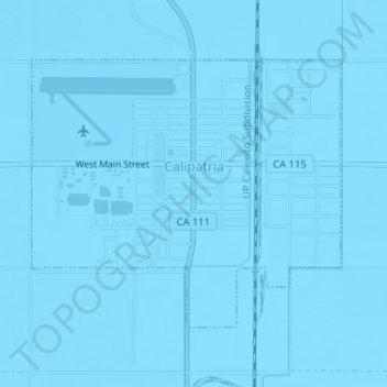
Nombre: Mapa topográfico Calipatria, altitud, relieve.
Lugar: Calipatria, Imperial County, California, United States (33.11432 -115.52771 33.13301 -115.50189)
Altitud media: -53 m
Altitud mínima: -57 m
Altitud máxima: -49 m
Haz una donación
Equípate para tu próxima aventura:
Como asociado de Amazon, este sitio gana comisiones por las compras que califican, sin ningún costo adicional para usted.