

Mapa topográfico Deoghar
Haga clic en el mapa para ver la altitud.
Deoghar
Deoghar is located at 24°29′N 86°41′E / 24.48°N 86.69°E / 24.48; 86.69. It has an average elevation of 255 metres (833 feet). It is a part of the Indian peninsular plateau which forms a part of the oldest landmass on Earth, Gondwana land. Deoghar is situated on the bank of Ajay river (which originates from Batpar village of Jamui district in Bihar) and its tributary Dadhawa river (which originates from Purnia Lake near Karangarh village 24°35′44″N 86°28′28″E / 24.595501°N 86.474369°E / 24.595501; 86.474369 in Jamui district of Bihar). The city is surrounded with various small relict hills such as Dighriya Pahaad, Nandan Pahaad, Trikuti Pahaad, and Tapovan Pahaad. Dighriya Pahaad forms the western boundary of the city and there is a national park being constructed on these hills. Nandan Pahaad is a children's amusement place and serves as one of the principal recreational places in the city. Tapovan Pahaad has its cultural relevance found in Hindu scriptures. It is one of the amusement places in the city and serves as a habitat for monkeys.
Acerca de este mapa
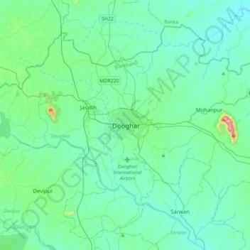
Nombre: Mapa topográfico Deoghar, altitud, relieve.
Lugar: Deoghar, Jharkhand, 814112, India (24.32983 86.53902 24.64983 86.85902)
Altitud media: 244 m
Altitud mínima: 169 m
Altitud máxima: 735 m