

Mapa topográfico Riofreddo
Haga clic en el mapa para ver la altitud.
Acerca de este mapa

Nombre: Mapa topográfico Riofreddo, altitud, relieve.
Lugar: Riofreddo, Murialdo, Savona, Liguria, Italy (44.25780 8.11776 44.29780 8.15776)
Altitud media: 816 m
Altitud mínima: 566 m
Altitud máxima: 1.193 m
Otros mapas topográficos
Haga clic en un mapa para ver su topografía, su altitud y su relieve.


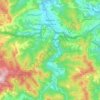


Bormida
Bormida is about 20 kilometres (12 mi) west of Savona (as the crow flies) in the upper Val Bormida between the mountain peaks of Settepani, elevation 1,386 metres (4,547 ft), and Ronco di Maglio, elevation 1,108 metres (3,635 ft). The Bormida di Pallare, a tributary of the Bormida di Spigno, flows through its…
Altitud media: 793 m
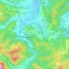


Bormida
Bormida is about 20 kilometres (12 mi) west of Savona (as the crow flies) in the upper Val Bormida between the mountain peaks of Settepani, elevation 1,386 metres (4,547 ft), and Ronco di Maglio, elevation 1,108 metres (3,635 ft). The Bormida di Pallare, a tributary of the Bormida di Spigno, flows through its…
Altitud media: 793 m


