Geolocalizar

Mapas topográficos Pathalam

Haga clic en un mapa para ver su topografía, su altitud y su relieve.
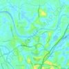
Periyar River

India > Kerala > Pathalam

The southernmost part of the Cardamom Hills i.e. the source of Periyar River is a narrow valley extending south of Kumily. This is the southern extreme of the Periyar basin. It is less than 20 kilometres (12 mi) wide and is about 40 kilometres (25 mi) long. The upper catchments of Periyar extend as a wedge…

Altitud media: 8 m

Equípate para tu próxima aventura:

🧥Chaquetas Impermeables Hombre - Protección total contra la lluvia y el viento (Gore-Tex y más)
🥤Botellas de Acero Inoxidable - Durabilidad y frescura para tu hidratación
🥾Botas de Senderismo para Hombre - Calzado robusto y protector para rutas por terrenos difíciles
🗺️Mapas de relieve 3D - Visualización del terreno
🧊Neveras Portátiles Flexibles - Mantiene tus alimentos frescos en el coche

Como asociado de Amazon, este sitio gana comisiones por las compras que califican, sin ningún costo adicional para usted.