
Mapa topográfico Elp
Mapa interactivo
Haga clic en el mapa para ver la altitud.
Acerca de este mapa
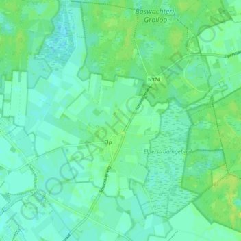
Nombre: Mapa topográfico Elp, altitud, relieve.
Lugar: Elp, Midden-Drenthe, Drenthe, Nederland (52.86070 6.61301 52.91281 6.68637)
Altitud media: 18 m
Altitud mínima: 13 m
Altitud máxima: 26 m
Otros mapas topográficos
Haga clic en un mapa para ver su topografía, su altitud y su relieve.
VAM Berg
Nederland > Drenthe > Midden-Drenthe
VAM Berg, De Brink, Wijster, Midden-Drenthe, Drenthe, Nederland, 9418 TL, Nederland
Altitud media: 17 m
Spier
Nederland > Drenthe > Midden-Drenthe
Spier, Midden-Drenthe, Drenthe, Nederland
Altitud media: 15 m
Lieving
Nederland > Drenthe > Midden-Drenthe > Lieving
Lieving, Midden-Drenthe, Drenthe, Nederland, 9411, Nederland
Altitud media: 15 m