
Mapa topográfico Spier
Mapa interactivo
Haga clic en el mapa para ver la altitud.
Acerca de este mapa
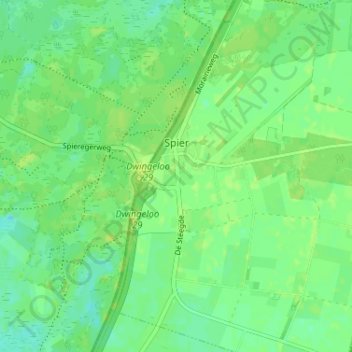
Nombre: Mapa topográfico Spier, altitud, relieve.
Lugar: Spier, Midden-Drenthe, Drenthe, Nederland (52.79589 6.45545 52.83496 6.49380)
Altitud media: 15 m
Altitud mínima: 8 m
Altitud máxima: 20 m
Otros mapas topográficos
Haga clic en un mapa para ver su topografía, su altitud y su relieve.
VAM Berg
Nederland > Drenthe > Midden-Drenthe
VAM Berg, De Brink, Wijster, Midden-Drenthe, Drenthe, Nederland, 9418 TL, Nederland
Altitud media: 17 m
Lieving
Nederland > Drenthe > Midden-Drenthe > Lieving
Lieving, Midden-Drenthe, Drenthe, Nederland, 9411, Nederland
Altitud media: 15 m