
Mapa topográfico Unionville
Mapa interactivo
Haga clic en el mapa para ver la altitud.
Acerca de este mapa
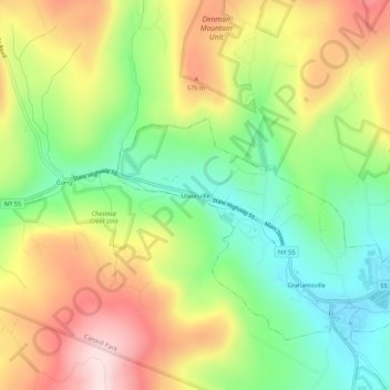
Nombre: Mapa topográfico Unionville, altitud, relieve.
Altitud media: 450 m
Altitud mínima: 270 m
Altitud máxima: 673 m
Otros mapas topográficos
Haga clic en un mapa para ver su topografía, su altitud y su relieve.
Claryville
United States > New York > Sullivan County > Town of Neversink
Claryville, Town of Neversink, Sullivan County, New York, 12725, United States
Altitud media: 628 m
Grahamsville
United States > New York > Sullivan County > Town of Neversink
Grahamsville, Town of Neversink, Sullivan County, New York, United States
Altitud media: 397 m
Willowemoc
United States > New York > Sullivan County > Town of Neversink
Willowemoc, Town of Neversink, Sullivan County, New York, United States
Altitud media: 630 m