Geolocalizar

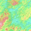
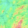
Mapa topográfico Beita

Haga clic en el mapa para ver la altitud.

Acerca de este mapa

Nombre: Mapa topográfico Beita, altitud, relieve.

Lugar: Beita, Beita District, Shaoyang, Hunan, China (27.08888 111.28647 27.40888 111.60647)

Altitud media: 278 m

Altitud mínima: 192 m

Altitud máxima: 1.182 m

Otros mapas topográficos

Haga clic en un mapa para ver su topografía, su altitud y su relieve.

Loudi

China > Hunan

The western parts of the city borders mountainous regions while the east parts is generally considered hilly with gently sloping topography.

Altitud media: 246 m

Xinhua County

China > Hunan > Loudi

Altitud media: 461 m

Jiahe County

China > Hunan > Chenzhou

Altitud media: 312 m

Tongmuluo

China > Hunan > Ningyuan County

Altitud media: 802 m

Ningyuan County

China > Hunan

Altitud media: 438 m

Liuyang

China > Hunan

Altitud media: 227 m

Dao County

China > Hunan

Altitud media: 464 m

Qingxi

China > Hunan > Shaoshan

Altitud media: 135 m

Shaoyang

China > Hunan

Altitud media: 494 m

Wulingyuan District

China > Hunan

Altitud media: 508 m

Xielingang

China > Hunan > Heshan District

Altitud media: 76 m

Nanjiang

China > Hunan > Pingjiang County

Altitud media: 382 m

Jishou

China > Hunan

Jishou lies east of the Wuling Mountain range. About 80% of the city's terrain is low hills or low mountains. The highest elevation is 964.5 meters, at Liantaifeng (莲台峰; 蓮台峰), near the town of Aizhai (矮寨) and the lowest point is 142 meters, near the town of Hexi (simplified Chinese: 河溪镇;…

Altitud media: 447 m

Anhua County

China > Hunan

Altitud media: 339 m

Zhangjiajie

China > Hunan

Altitud media: 556 m

Wulingyuan District

China > Hunan

Altitud media: 508 m

Changsha

China > Hunan

Altitud media: 180 m

Zhangjiajie

China > Hunan

Altitud media: 556 m

Hengyang

China > Hunan

A Roman Catholic diocese of Hengzhou was established, although periodically suppressed. This was suffragan to the Archbishop of Changsha following its elevation in 1946.

Altitud media: 205 m

Jundeping

China > Hunan

Altitud media: 586 m

Shaoshan

China > Hunan

Shaoshan's topography is dominated by Mt. Shaofeng and the Shao and Shishi Rivers, with hills in the west giving rise to a mix of hills and plains in the east. The peak of Mount Shaofeng, 518.5 m above sea level, is the highest point whereas Liumuzhou, 48 m above sea level, is the lowest point of the whole…

Altitud media: 115 m

Yiyang

China > Hunan

Altitud media: 148 m

Xiangxi

China > Hunan

Xiangxi Tujia and Miao Autonomous Prefecture is located in a low-latitude zone and has a humid subtropical monsoon climate. It is characterized by the influence of the topography of the Wuling Mountains: the winter is relatively cold, the summer temperature is high and humid, the spring and summer are wet and…

Altitud media: 547 m

Baojing County

China > Hunan

Altitud media: 518 m

Pingjiang County

China > Hunan

Altitud media: 267 m

Lingling District

China > Hunan

Altitud media: 372 m

Anhua County

China > Hunan

Altitud media: 339 m

Jishou

China > Hunan

Jishou lies east of the Wuling Mountain range. About 80% of the city's terrain is low hills or low mountains. The highest elevation is 964.5 meters, at Liantaifeng (莲台峰; 蓮台峰, near the town of Aizhai (矮寨) and the lowest point is 142 meters, near the town of Hexi (simplified Chinese: 河溪镇;…

Altitud media: 447 m

You County

China > Hunan

Altitud media: 254 m

Ningyuan County

China > Hunan

Altitud media: 438 m

Guidong County

China > Hunan

Guidong County belongs to the subtropical monsoon humid climate zone, no summer heat, no winter cold, warm and humid, four seasons. In spring, the southeast wind into the cold and warm air masses fronts in the territory of the confrontation hovering, insufficient light, cloudy temperature and rain. In summer,…

Altitud media: 887 m

Yongzhou

China > Hunan

Altitud media: 442 m

Xinhua County

China > Hunan > Loudi

Altitud media: 461 m

Sangzhi County

China > Hunan

Altitud media: 751 m

Longshan County

China > Hunan

Altitud media: 635 m

Shimen County

China > Hunan > Changde

Altitud media: 407 m

Fenghuang County

China > Hunan

Altitud media: 497 m

Huarong County

China > Hunan

Altitud media: 34 m

Shigu District

China > Hunan

Altitud media: 71 m

Qiyang

China > Hunan

Altitud media: 251 m

Yueyang

China > Hunan

Altitud media: 140 m

Li County

China > Hunan > Changde

Altitud media: 104 m

Changsha

China > Hunan

Altitud media: 180 m

Changde

China > Hunan

The larger prefecture-level city of Changde is adjacent to Dongting Lake to the east, the city of Yiyang to the south, Wuling and Xuefeng Mountains to the west, and Hubei province to the north. Near the border with Hubei province in Shimen county is Huping Mountain (壶瓶山), the highest peaks in Hunan…

Altitud media: 171 m
Wu River

China > Hunan > Jishou > Jishou > Aizhai

Altitud media: 479 m

Huaihua

China > Hunan

Altitud media: 522 m

You County

China > Hunan

Altitud media: 254 m

Changsha

China > Hunan

Altitud media: 180 m

Wuling District

China > Hunan > Changde

Altitud media: 52 m

Changde

China > Hunan

The larger prefecture-level city of Changde is adjacent to Dongting Lake to the east, the city of Yiyang to the south, Wuling and Xuefeng Mountains to the west, and Hubei province to the north. Near the border with Hubei province in Shimen county is Huping Mountain (壶瓶山), the highest peaks in Hunan…

Altitud media: 171 m

Shaoyang

China > Hunan

Altitud media: 494 m

Renminlu Subdistrict

China > Hunan

Altitud media: 181 m

Zhangjiajie

China > Hunan

Altitud media: 556 m

Luoguta

China > Hunan

Altitud media: 717 m

Yueyang

China > Hunan

Altitud media: 140 m

Zhuzhou

China > Hunan

Altitud media: 274 m

Chenzhou

China > Hunan

Altitud media: 443 m

Yueyang

China > Hunan

Altitud media: 140 m

Changsha

China > Hunan

Altitud media: 180 m

Changde

China > Hunan

Altitud media: 171 m

Huaihua

China > Hunan

Altitud media: 522 m

Liling

China > Hunan

Zhangxianling (彰仙岭) is the second highest natural elevation in the city, which is 707 metres (2,320 ft) above sea level.

Altitud media: 142 m

Hengdong County

China > Hunan > Hengdong County > Hengyang

Altitud media: 143 m

Lukou District

China > Hunan

Altitud media: 113 m

Wuling District

China > Hunan

Altitud media: 50 m

Equípate para tu próxima aventura:

🧦Calcetines de Lana Merino - Aislamiento premium para climas fríos
👖Mallas Térmicas Mujer - Aislamiento suave para condiciones de frío
👟Sandalias de Trekking Hombre - Calzado ventilado para rutas con cruce de ríos
👟Zapatillas de trekking - Calzado ligero para caminatas y senderos
👟Zapatillas de Trail Running Hombre - Calzado ligero y con tracción para correr por senderos

Como asociado de Amazon, este sitio gana comisiones por las compras que califican, sin ningún costo adicional para usted.