Geolocalizar

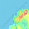
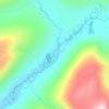
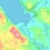
Mapa topográfico Loch Tarff

Haga clic en el mapa para ver la altitud.

Acerca de este mapa

Nombre: Mapa topográfico Loch Tarff, altitud, relieve.

Lugar: Loch Tarff, Highland, Scotland, United Kingdom (57.14902 -4.61240 57.15821 -4.59580)

Altitud media: 322 m

Altitud mínima: 15 m

Altitud máxima: 509 m

Otros mapas topográficos

Haga clic en un mapa para ver su topografía, su altitud y su relieve.
Aviemore

United Kingdom > Scotland > Highland

Altitud media: 332 m

Scottish Highlands

United Kingdom > Scotland > Highland

The entire region was covered by ice sheets during the Pleistocene ice ages, save perhaps for a few nunataks. The complex geomorphology includes incised valleys and lochs carved by the action of mountain streams and ice, and a topography of irregularly distributed mountains whose summits have similar heights…

Altitud media: 907 m

Scottish Highlands

United Kingdom > Scotland > Highland

The Scottish Highlands are renowned for their rugged, mountainous terrain that dominates much of the region. Stretching across the northern and central parts of Scotland, the landscape is shaped by ancient geological forces, including the Caledonian Orogeny, which caused significant tectonic collisions…

Altitud media: 907 m
Thurso

United Kingdom > Scotland > Highland

Altitud media: 25 m

Inverness

United Kingdom > Scotland > Highland

Altitud media: 163 m

Altnaharra

United Kingdom > Scotland > Highland

Altitud media: 126 m

Portree

United Kingdom > Scotland > Highland

Altitud media: 121 m

Drimnin

United Kingdom > Scotland > Highland > Bonnavoulin

Altitud media: 83 m

Ben More Coigach

United Kingdom > Scotland > Highland

Ben Mor Coigach (Scottish Gaelic: Beinn Mhòr na Còigich) is the highest point along a ridge rising steeply from Loch Broom, in the far northwest of Scotland. It rises above the Coigach peninsula in the county of Ross and Cromarty, 10 kilometres northwest of Ullapool, reaching a height of 743 metres (2,438…

Altitud media: 452 m
Glencoe

United Kingdom > Scotland > Highland

Altitud media: 114 m

Fort William

United Kingdom > Scotland > Highland

Fort William has an oceanic climate (Cfb) with moderate, but generally cool, temperatures and abundant precipitation. In the towns immediate vicinity, there are significant variations in elevation, which leads to some uninhabited areas near the town having a subpolar oceanic climate (Cfc), or, at the absolute…

Altitud media: 122 m
Dundreggan

United Kingdom > Scotland > Highland

Altitud media: 250 m

Loch Ossian

United Kingdom > Scotland > Highland

Altitud media: 538 m

Glen Etive

United Kingdom > Scotland > Highland

Altitud media: 477 m

Invergarry Castle

United Kingdom > Scotland > Highland > Invergarry

The survey drawing shows a plan and elevations of the castle, called the 'Castle of Glangary' on the drawing. The drawing may appear misleading, as more than one facade is joined together, but by cross-referencing the lettering on the plan to the elevations the appearance can be judged.

Altitud media: 150 m
Invermoriston

United Kingdom > Scotland > Highland

Altitud media: 212 m

Staffin

United Kingdom > Scotland > Highland

Altitud media: 42 m

Tongue

United Kingdom > Scotland > Highland

Altitud media: 91 m

North Watten

United Kingdom > Scotland > Highland

Altitud media: 51 m

Halkirk

United Kingdom > Scotland > Highland

Altitud media: 49 m

Aultbea

United Kingdom > Scotland > Highland

Altitud media: 44 m

Ardgay

United Kingdom > Scotland > Highland

Altitud media: 48 m

River Nairn

United Kingdom > Scotland > Highland > Nairn

Altitud media: 178 m

Quiraing

United Kingdom > Scotland > Highland

Altitud media: 298 m

Loch Hourn

United Kingdom > Scotland > Highland

Altitud media: 283 m

Struy

United Kingdom > Scotland > Highland

Altitud media: 164 m

Scalpay

United Kingdom > Scotland > Highland

Altitud media: 89 m

Brora

United Kingdom > Scotland > Highland

Altitud media: 14 m

Loch Ashie

United Kingdom > Scotland > Highland > Inverness

Altitud media: 228 m

Mallaig

United Kingdom > Scotland > Highland

Altitud media: 25 m

Chalamain Gap

United Kingdom > Scotland > Highland

Altitud media: 666 m

Aonach Mor

United Kingdom > Scotland > Highland

Altitud media: 550 m

Aonach Mòr

United Kingdom > Scotland > Highland

Aonach Mòr is a mountain in the Scottish Highlands. It is located about two miles (three kilometres) northeast of Ben Nevis on the south side of Glen Spean, near Fort William. The mountain has a summit elevation of 4,006 ft (1,221 m) and is classified as a Munro.

Altitud media: 898 m

Loch Kemp

United Kingdom > Scotland > Highland

Altitud media: 181 m

Binnein Mor

United Kingdom > Scotland > Highland

Altitud media: 745 m

Elphin

United Kingdom > Scotland > Highland

Altitud media: 167 m

Bonar Bridge

United Kingdom > Scotland > Highland

Altitud media: 40 m

Hallival

United Kingdom > Scotland > Highland

Altitud media: 396 m

River Etive

United Kingdom > Scotland > Highland

Altitud media: 472 m

Loch Fannich

United Kingdom > Scotland > Highland

Altitud media: 463 m

Raddery

United Kingdom > Scotland > Highland > Fortrose

Altitud media: 129 m

Eriboll

United Kingdom > Scotland > Highland

Altitud media: 92 m

Corpach

United Kingdom > Scotland > Highland

Altitud media: 83 m

Ardnarff

United Kingdom > Scotland > Highland

Altitud media: 156 m

Whitebridge

United Kingdom > Scotland > Highland

Altitud media: 223 m

Langdale

United Kingdom > Scotland > Highland

Altitud media: 115 m

Davochfin

United Kingdom > Scotland > Highland > Dornoch

Altitud media: 13 m

Melvaig

United Kingdom > Scotland > Highland

Altitud media: 90 m

Strathpeffer

United Kingdom > Scotland > Highland

It lies in a strath 5 miles (8 km) west of Dingwall, with the elevation ranging from 60 to 120 m (200 to 400 ft) above sea level. Sheltered on the west and north, it has a comparatively dry and warm climate.

Altitud media: 127 m

Newtonmore

United Kingdom > Scotland > Highland

Newtonmore is located within the Cairngorms National Park, approximately 3 miles (5 km) southwest of Kingussie and 15 miles (24 km) southwest of Aviemore. It is on the northeastern bank of the River Spey, between the River Calder and the Allt Lairaidh, at an altitude of approximately 250 metres (820 ft).

Altitud media: 283 m
Avoch

United Kingdom > Scotland > Highland

Altitud media: 50 m

Scotscalder

United Kingdom > Scotland > Highland

Altitud media: 72 m

Wick

United Kingdom > Scotland > Highland

Altitud media: 20 m

Kingussie

United Kingdom > Scotland > Highland

Altitud media: 338 m

Lairg

United Kingdom > Scotland > Highland

Altitud media: 129 m

Insh

United Kingdom > Scotland > Highland

Altitud media: 275 m

Lyth

United Kingdom > Scotland > Highland

Altitud media: 29 m

Caol

United Kingdom > Scotland > Highland

Altitud media: 38 m

Ben Nevis

United Kingdom > Scotland > Highland

Ben Nevis has a highland (alpine) maritime (oceanic) polar climate (ET climate in the Köppen classification). Ben Nevis's elevation, maritime location and topography frequently lead to cool and cloudy weather conditions, which can pose a danger to ill-equipped walkers. According to the observations carried…

Altitud media: 912 m
Glasnakille

United Kingdom > Scotland > Highland

Altitud media: 39 m

Ballachulish

United Kingdom > Scotland > Highland

Altitud media: 160 m

Clachtoll

United Kingdom > Scotland > Highland

Altitud media: 38 m

Dounreay

United Kingdom > Scotland > Highland

Altitud media: 36 m

Achmelvich

United Kingdom > Scotland > Highland

Altitud media: 58 m

Inverinate

United Kingdom > Scotland > Highland

Altitud media: 186 m

Knockdee

United Kingdom > Scotland > Highland

Altitud media: 66 m

Poolewe

United Kingdom > Scotland > Highland

Altitud media: 58 m

Forsinard

United Kingdom > Scotland > Highland

Altitud media: 171 m

Fearnmore

United Kingdom > Scotland > Highland

Altitud media: 22 m

Milovaig

United Kingdom > Scotland > Highland

Altitud media: 72 m

Tarvie

United Kingdom > Scotland > Highland

Altitud media: 135 m

The Storr

United Kingdom > Scotland > Highland

Altitud media: 396 m

Foyers

United Kingdom > Scotland > Highland

Altitud media: 124 m

Spean Bridge

United Kingdom > Scotland > Highland

Altitud media: 141 m

Gillock

United Kingdom > Scotland > Highland > Wick

Altitud media: 22 m

Farrmheall

United Kingdom > Scotland > Highland

Altitud media: 281 m

Laide

United Kingdom > Scotland > Highland

Altitud media: 47 m

Gartymore

United Kingdom > Scotland > Highland > Portgower

Altitud media: 94 m

Kilbride

United Kingdom > Scotland > Highland

Altitud media: 116 m

Kylesku

United Kingdom > Scotland > Highland

Altitud media: 82 m

Equípate para tu próxima aventura:

🔥Iniciadores de Fuego - Asegura tu calor y cocina incluso en condiciones húmedas
🧦Calcetines de lana merino - Confort térmico natural
👟Sandalias de Trekking Mujer - Protección y frescura para el verano
🌧️Ponchos impermeables - Protección rápida contra lluvia
🧵Ropa técnica de senderismo - Ropa transpirable y resistente para outdoor

Como asociado de Amazon, este sitio gana comisiones por las compras que califican, sin ningún costo adicional para usted.