Geolocalizar

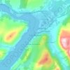
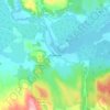
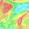
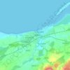
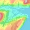
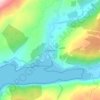
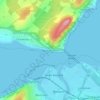
Mapa topográfico Whitebridge

Haga clic en el mapa para ver la altitud.

Acerca de este mapa

Nombre: Mapa topográfico Whitebridge, altitud, relieve.

Lugar: Whitebridge, Highland, Scotland, IV2 6UW, United Kingdom (57.20217 -4.50954 57.20652 -4.49998)

Altitud media: 223 m

Altitud mínima: 163 m

Altitud máxima: 460 m

Otros mapas topográficos

Haga clic en un mapa para ver su topografía, su altitud y su relieve.
Glencoe

United Kingdom > Scotland > Highland

Altitud media: 114 m

Fort William

United Kingdom > Scotland > Highland

Fort William has an oceanic climate (Cfb) with moderate, but generally cool, temperatures and abundant precipitation. In the towns immediate vicinity, there are significant variations in elevation, which leads to some uninhabited areas near the town having a subpolar oceanic climate (Cfc), or, at the absolute…

Altitud media: 122 m
Scottish Highlands

United Kingdom > Scotland > Highland

The entire region was covered by ice sheets during the Pleistocene ice ages, save perhaps for a few nunataks. The complex geomorphology includes incised valleys and lochs carved by the action of mountain streams and ice, and a topography of irregularly distributed mountains whose summits have similar heights…

Altitud media: 907 m
Aviemore

United Kingdom > Scotland > Highland

Altitud media: 331 m

Skye

United Kingdom > Scotland > Highland

Beyond Loch Snizort to the west of Trotternish is the Waternish peninsula, which ends in Ardmore Point's double rock arch. Duirinish peninsula is separated from Waternish by Loch Dunvegan, which contains the island of Isay. It is ringed by sea cliffs that reach 296 metres (971 feet) on the west at Waterstein…

Altitud media: 63 m

Scottish Highlands

United Kingdom > Scotland > Highland

The Scottish Highlands are renowned for their rugged, mountainous terrain that dominates much of the region. Stretching across the northern and central parts of Scotland, the landscape is shaped by ancient geological forces, including the Caledonian Orogeny, which caused significant tectonic collisions…

Altitud media: 907 m
Gairloch

United Kingdom > Scotland > Highland

Altitud media: 77 m

Ben Nevis

United Kingdom > Scotland > Highland

Ben Nevis has a highland (alpine) maritime (oceanic) polar climate (ET climate in the Köppen classification). Ben Nevis's elevation, maritime location and topography frequently lead to cool and cloudy weather conditions, which can pose a danger to ill-equipped walkers. According to the observations carried…

Altitud media: 912 m
Inverness

United Kingdom > Scotland > Highland

Altitud media: 163 m

Lairg

United Kingdom > Scotland > Highland

Altitud media: 129 m

Fearnmore

United Kingdom > Scotland > Highland

Altitud media: 22 m

Tarvie

United Kingdom > Scotland > Highland

Altitud media: 135 m

Halkirk

United Kingdom > Scotland > Highland

Altitud media: 49 m

Scourie

United Kingdom > Scotland > Highland

Altitud media: 51 m

Acharacle

United Kingdom > Scotland > Highland

Altitud media: 46 m

Duror

United Kingdom > Scotland > Highland

Altitud media: 129 m

Annat

United Kingdom > Scotland > Highland

Altitud media: 152 m

Gorthleck

United Kingdom > Scotland > Highland

Altitud media: 215 m

Carn Dearg

United Kingdom > Scotland > Highland

Altitud media: 711 m

Corpach

United Kingdom > Scotland > Highland

Altitud media: 83 m

Ardnarff

United Kingdom > Scotland > Highland

Altitud media: 156 m

Langdale

United Kingdom > Scotland > Highland

Altitud media: 115 m

Strathpeffer

United Kingdom > Scotland > Highland

It lies in a strath 5 miles (8 km) west of Dingwall, with the elevation ranging from 60 to 120 m (200 to 400 ft) above sea level. Sheltered on the west and north, it has a comparatively dry and warm climate.

Altitud media: 127 m
Invermoriston

United Kingdom > Scotland > Highland

Altitud media: 212 m

Newtonmore

United Kingdom > Scotland > Highland

Newtonmore is located within the Cairngorms National Park, approximately 3 miles (5 km) southwest of Kingussie and 15 miles (24 km) southwest of Aviemore. It is on the northeastern bank of the River Spey, between the River Calder and the Allt Lairaidh, at an altitude of approximately 250 metres (820 ft).

Altitud media: 283 m
Kingussie

United Kingdom > Scotland > Highland

Altitud media: 338 m

Loch Morar

United Kingdom > Scotland > Highland > Morar

Loch Morar (Scottish Gaelic: Loch Mòrair) is a freshwater loch in Lochaber, Highland, Scotland. It is the fifth-largest loch by surface area in Scotland, at 26.7 km2 (10.3 sq mi), and the deepest freshwater body in the British Isles with a maximum depth of 310 m (1,017 ft). The loch was created by glacial…

Altitud media: 118 m
Knockdee

United Kingdom > Scotland > Highland

Altitud media: 66 m

North Watten

United Kingdom > Scotland > Highland

Altitud media: 51 m

Loch Tarff

United Kingdom > Scotland > Highland

Altitud media: 322 m

Poolewe

United Kingdom > Scotland > Highland

Altitud media: 58 m

Altnaharra

United Kingdom > Scotland > Highland

Altitud media: 126 m

Milovaig

United Kingdom > Scotland > Highland

Altitud media: 72 m

The Storr

United Kingdom > Scotland > Highland

Altitud media: 396 m

Foyers

United Kingdom > Scotland > Highland

Altitud media: 124 m

Ardgour

United Kingdom > Scotland > Highland

Altitud media: 235 m

Farrmheall

United Kingdom > Scotland > Highland

Altitud media: 281 m

Gartymore

United Kingdom > Scotland > Highland > Portgower

Altitud media: 94 m

Aultbea

United Kingdom > Scotland > Highland

Altitud media: 44 m

Kilbride

United Kingdom > Scotland > Highland

Altitud media: 116 m

Dundreggan

United Kingdom > Scotland > Highland

Altitud media: 250 m

Drumchork

United Kingdom > Scotland > Highland > Aultbea

Altitud media: 50 m

Nairn

United Kingdom > Scotland > Highland

Altitud media: 18 m

Nethy Bridge

United Kingdom > Scotland > Highland

Altitud media: 230 m

Loch Ness

United Kingdom > Scotland > Highland > Dores

Altitud media: 340 m

Daviot

United Kingdom > Scotland > Highland

Altitud media: 230 m

River Brora

United Kingdom > Scotland > Highland

Altitud media: 216 m

Inver

United Kingdom > Scotland > Highland

Altitud media: 8 m

Farr

United Kingdom > Scotland > Highland > Bettyhill

Altitud media: 39 m

Loch Ewe

United Kingdom > Scotland > Highland > Poolewe

Altitud media: 64 m

Brin

United Kingdom > Scotland > Highland > Brin

Altitud media: 283 m

Lewiston

United Kingdom > Scotland > Highland > Lewiston

Altitud media: 126 m

Linside

United Kingdom > Scotland > Highland > Linside

Altitud media: 121 m

Arisaig

United Kingdom > Scotland > Highland

Altitud media: 54 m

Drimnin

United Kingdom > Scotland > Highland > Bonnavoulin

Altitud media: 83 m

Slioch

United Kingdom > Scotland > Highland

Slioch is unusual in being bounded on three sides by waters flowing south-east (Lochan Fada), then south-west (Gleann Bianasdail) and finally north-west (Loch Maree). Ordnance Survey maps show Lochan Fada as having two outlets at its south-east end, the second being via Gleann na Muice to Kinlochewe and Loch…

Altitud media: 533 m

Feshiebridge

United Kingdom > Scotland > Highland

Altitud media: 277 m

Strontian

United Kingdom > Scotland > Highland

Altitud media: 97 m

Struanmor

United Kingdom > Scotland > Highland > Struan

Altitud media: 40 m

Peinmore

United Kingdom > Scotland > Highland > Portree

Altitud media: 122 m

Balgown

United Kingdom > Scotland > Highland > Struan

Altitud media: 58 m

Faillie

United Kingdom > Scotland > Highland > Daviot

Altitud media: 228 m

Brora

United Kingdom > Scotland > Highland

Altitud media: 14 m

Isauld

United Kingdom > Scotland > Highland > Reay

Altitud media: 30 m

Lochcarron

United Kingdom > Scotland > Highland

Altitud media: 67 m

Stromeferry

United Kingdom > Scotland > Highland

Altitud media: 87 m

Lochinver

United Kingdom > Scotland > Highland

Altitud media: 62 m

Maryburgh

United Kingdom > Scotland > Highland

Altitud media: 56 m

Creag Mèagaidh

United Kingdom > Scotland > Highland

There are three species of deer found at Creag Meagaidh NNR: red, roe and sika. Deer management to reduce numbers takes place at Creag Meagaidh in order to facilitate woodland regeneration. Mountain hares are common on the higher parts of the reserve, whilst pine marten and otter can occasionally be found at…

Altitud media: 928 m
Tomich

United Kingdom > Scotland > Highland

Altitud media: 218 m

Mam Sodhail

United Kingdom > Scotland > Highland

Altitud media: 876 m

Suilven

United Kingdom > Scotland > Highland

Altitud media: 293 m

Sgùrr Fhuaran

United Kingdom > Scotland > Highland

The mountain reaches a height of 1,067 metres (3,501 ft) and qualifies as a Munro and a Marilyn; it is the highest point for a significant distance, having a sizeable topographic prominence of 663 metres (2,175 ft) and giving extensive views from its summit.

Altitud media: 604 m

Askival

United Kingdom > Scotland > Highland

Altitud media: 401 m

Hallival

United Kingdom > Scotland > Highland

Altitud media: 396 m

Ben Starav

United Kingdom > Scotland > Highland

Altitud media: 617 m

The Saddle

United Kingdom > Scotland > Highland

Altitud media: 660 m

Loch Dunvegan

United Kingdom > Scotland > Highland > Stein

Altitud media: 61 m

Equípate para tu próxima aventura:

🚲Luces de Bicicleta Potentes - Visibilidad y seguridad en tramos de carretera
🛌Esterillas Autoinflables - Aislamiento del suelo para un descanso reparador
🧳Mochilas trail running - Ligereza para rutas rápidas
🔭Binoculares Compactos - Observa el relieve y la fauna con nitidez
🕶️Gafas de sol de montaña - Protección ocular en exterior

Como asociado de Amazon, este sitio gana comisiones por las compras que califican, sin ningún costo adicional para usted.