
Mapa topográfico Omsk
Mapa interactivo
Haga clic en el mapa para ver la altitud.
Acerca de este mapa
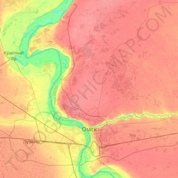
Nombre: Mapa topográfico Omsk, altitud, relieve.
Lugar: Omsk, Omsk Oblast, Siberian Federal District, 644000, Russia (54.82404 73.09753 55.42657 73.62868)
Altitud media: 107 m
Altitud mínima: 63 m
Altitud máxima: 143 m
Omsk is in the south of the West Siberian Plain, along the banks of the north-flowing Irtysh, at its confluence with the Om River. The city has an elevation of 87 meters (285 ft) above mean sea level at its highest point.
Otros mapas topográficos
Haga clic en un mapa para ver su topografía, su altitud y su relieve.
Omsk
Russia > Omsk Oblast > Omsk > Omsk
Omsk, Omsk Oblast, Siberian Federal District, 644000, Russia
Altitud media: 105 m