

Mapa topográfico Dacorum
Haga clic en el mapa para ver la altitud.
Acerca de este mapa

Nombre: Mapa topográfico Dacorum, altitud, relieve.
Lugar: Dacorum, Hertfordshire, England, United Kingdom (51.67983 -0.74579 51.85813 -0.40488)
Altitud media: 142 m
Altitud mínima: 55 m
Altitud máxima: 270 m
Otros mapas topográficos
Haga clic en un mapa para ver su topografía, su altitud y su relieve.


Cassiobury Park
United Kingdom > England > Hertfordshire > Watford > Watford > Croxley Green
Altitud media: 71 m
St Albans
United Kingdom > England > Hertfordshire > St Albans
St Albans was an ancient borough created following the dissolution of the monastery in 1539. It consisted of the ancient parish of St Albans (also known as the Abbey parish) and parts of St Michael and St Peter. The municipal corporation was reformed by the Municipal Corporations Act 1835 and the boundary was…
Altitud media: 100 m

Spellbrook
United Kingdom > England > Hertfordshire > East Hertfordshire > Sawbridgeworth
Altitud media: 71 m
Highfield Park
United Kingdom > England > Hertfordshire > St Albans > Colney Heath
Altitud media: 87 m


Letchworth
United Kingdom > England > Hertfordshire > North Hertfordshire > Letchworth
Altitud media: 80 m

Astonbury Wood
United Kingdom > England > Hertfordshire > East Hertfordshire > Aston
Altitud media: 83 m


Ashbrook
United Kingdom > England > Hertfordshire > North Hertfordshire > St Ippolyts
Altitud media: 85 m





Baker's End
United Kingdom > England > Hertfordshire > East Hertfordshire > Wareside > Baker's End
Altitud media: 73 m
Waterford
United Kingdom > England > Hertfordshire > East Hertfordshire > Waterford
Altitud media: 66 m
Great Wood Northaw Country Park
United Kingdom > England > Hertfordshire > Welwyn Hatfield > Hatfield
Altitud media: 106 m

Hare Street
United Kingdom > England > Hertfordshire > East Hertfordshire > Great Hormead
Altitud media: 110 m

Hertford Heath Nature Reserve
United Kingdom > England > Hertfordshire > East Hertfordshire > Hertford Heath
Altitud media: 79 m

Painter's Green
United Kingdom > England > Hertfordshire > East Hertfordshire > Datchworth
Altitud media: 100 m
Merry Hill
United Kingdom > England > Hertfordshire > Hertsmere > Bushey Heath > Merry Hill
Altitud media: 98 m
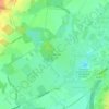
Ellenbrook Fields
United Kingdom > England > Hertfordshire > Welwyn Hatfield > Hatfield
Altitud media: 80 m
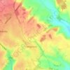
Cockernhoe
United Kingdom > England > Hertfordshire > North Hertfordshire > Offley > Cockernhoe
Altitud media: 149 m
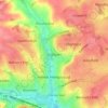
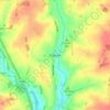
Windmill Hill
United Kingdom > England > Hertfordshire > North Hertfordshire > Hitchin
Altitud media: 74 m
Napsbury Park
United Kingdom > England > Hertfordshire > St Albans > London Colney
Altitud media: 78 m
Well End
United Kingdom > England > Hertfordshire > Hertsmere > Borehamwood > Shenley
Altitud media: 108 m
Offley Hoo
United Kingdom > England > Hertfordshire > North Hertfordshire > Offley
Altitud media: 134 m
Moor Green
United Kingdom > England > Hertfordshire > East Hertfordshire > Ardeley
Altitud media: 123 m

Primrosehill
United Kingdom > England > Hertfordshire > Three Rivers > Abbots Langley
Altitud media: 111 m
Saint Margarets Copse
United Kingdom > England > Hertfordshire > Dacorum > Great Gaddesden
Altitud media: 144 m
Mardley Heath
United Kingdom > England > Hertfordshire > Welwyn Hatfield > Oaklands
Altitud media: 110 m

Throcking
United Kingdom > England > Hertfordshire > East Hertfordshire > Buntingford
Altitud media: 126 m

Temple Dinsley
United Kingdom > England > Hertfordshire > North Hertfordshire > Preston
Altitud media: 124 m
Bendish
United Kingdom > England > Hertfordshire > North Hertfordshire > Breachwood Green
Altitud media: 128 m
Gobions Pond
United Kingdom > England > Hertfordshire > Welwyn Hatfield > Brookmans Park > Swanley Bar
Altitud media: 106 m
Blackmore End
United Kingdom > England > Hertfordshire > St Albans > Wheathampstead
Altitud media: 114 m
Tewin Wood
United Kingdom > England > Hertfordshire > East Hertfordshire > Burnham Green
Altitud media: 101 m
Tringford Reservoir
United Kingdom > England > Hertfordshire > Dacorum > Tring > Wilstone
Altitud media: 119 m
Knebworth Country Park
United Kingdom > England > Hertfordshire > North Hertfordshire > Knebworth
Altitud media: 116 m


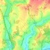
Chapmore End
United Kingdom > England > Hertfordshire > East Hertfordshire > Tonwell
Altitud media: 65 m
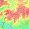
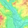
Stanstead St Margarets
United Kingdom > England > Hertfordshire > East Hertfordshire
Altitud media: 48 m

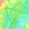


Hadham Cross
United Kingdom > England > Hertfordshire > East Hertfordshire > Much Hadham
Altitud media: 79 m


Thorley Street
United Kingdom > England > Hertfordshire > East Hertfordshire > Thorley
Altitud media: 74 m