
Mapa topográfico Botyre
Mapa interactivo
Haga clic en el mapa para ver la altitud.
Acerca de este mapa
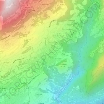
Nombre: Mapa topográfico Botyre, altitud, relieve.
Lugar: Botyre, Ayent, Ering, Wallis, 1966, Schweiz (46.25724 7.38859 46.29724 7.42859)
Altitud media: 1.014 m
Altitud mínima: 501 m
Altitud máxima: 1.861 m
Otros mapas topográficos
Haga clic en un mapa para ver su topografía, su altitud y su relieve.