

Mapa topográfico Tapti River
Haga clic en el mapa para ver la altitud.
Acerca de este mapa

Nombre: Mapa topográfico Tapti River, altitud, relieve.
Lugar: Tapti River, India (21.05455 72.65954 21.82126 78.19657)
Altitud media: 374 m
Altitud mínima: -1 m
Altitud máxima: 1.418 m
Otros mapas topográficos
Haga clic en un mapa para ver su topografía, su altitud y su relieve.

Dehradun
India > Uttarakhand > Dehradun
The city of Dehradun mainly lies in Doon Valley and is at a varying height from 410 m (1,350 ft) in Clement Town to above 700 m (2,300 ft) at Malsi which is 15 km (9.3 mi) from the city. However, the average elevation is 450 m (1,480 ft) above sea level. Malsi is the starting point of Lesser Himalayan Range…
Altitud media: 904 m

Bobbili
India > Andhra Pradesh > Bobbili
Bobbili is located at 18°34′00″N 83°22′00″E / 18.5667°N 83.3667°E / 18.5667; 83.3667. It has an average elevation of 103 metres (337 feet).
Altitud media: 130 m

Bhubaneshwar
India > Odisha > Bhubaneswar (M.Corp.)
Bhubaneswar is in Khordha district of Odisha. It is in the eastern coastal plains, along the axis of the Eastern Ghats mountains. The city has an average altitude of 45 m (148 ft) above sea level. It lies southwest of the Mahanadi River that forms the northern boundary of Bhubaneswar metropolitan area, within…
Altitud media: 30 m
Ajinkyatara Fort
India > Maharashtra > Satara > Satara
Ajinkyatara Fort, also known as the "Fort of the Sapta-Rishi," is a historical hill fort located on Ajinkyatara Mountain, one of the seven mountains surrounding the city of Satara in the Sahyadri Mountains of Maharashtra, India. Situated at an altitude of 3,300 feet, the fort overlooks Satara City and is…
Altitud media: 764 m

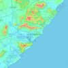
Visakhapatnam
India > Andhra Pradesh > Visakhapatnam Urban
The city is situated between the Eastern Ghats and the Bay of Bengal. The city coordinates lies between 17.7041 N and 83.2977 E. The city's area is 682 km2. The average elevation is 45 metres. Visakhpatnam is situated in Coastal Andhra Region.
Altitud media: 35 m


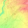
Vadodara
India > Gujarat > Vadodara Rural Taluka
Vadodara is located at 22°18′N 73°11′E / 22.30°N 73.19°E / 22.30; 73.19 in western India at an elevation of 39 metres (128 ft). It is the tenth-largest city in India with an area of 400 square kilometres (150 sq mi) and a population of 3.5 million, according to the 2010–11 census. The city…
Altitud media: 36 m
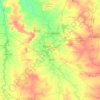
Ujjain
India > Madhya Pradesh > Ujjain NagarTahsil
Ujjain is located in the west-central part of India, and is north of the upper limit of the Vindhya mountain ranges. Located on the Malwa plateau, it is higher than the north Indian plains and the land rises towards the Vindhya Range to the south. Ujjain's co-ordinates are 23°10′N 75°46′E /…
Altitud media: 501 m
Mumbai
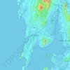
Mumbai lies at the mouth of the Ulhas River on the western coast of India, in the coastal region known as the Konkan. It sits on Salsette Island (Sashti Island), which it partially shares with the Thane district. Mumbai is bounded by the Arabian Sea to the west. Many parts of the city lie just above sea level,…
Altitud media: 13 m

Guntakal
India > Andhra Pradesh > Guntakal
Guntakal is located at 15°10′N 77°23′E / 15.17°N 77.38°E / 15.17; 77.38. It has an average elevation of 432 metres (1,417 ft).
Altitud media: 445 m

Damdim
India > West Bengal > Mal
Dam Dim is located at 26°51′56″N 88°40′11″E / 26.8656°N 88.6698°E / 26.8656; 88.6698 at an elevation of 141 m above MSL.
Altitud media: 161 m

Piravom
India > Kerala > Muvattupuzha
Piravom was reverted to panchayat status in 1992 after two years as a municipality because of skepticism that its classification as a municipality would attract higher tax rates and building regulation. However, as modern municipal councils now have the authority to fix the tax rate and new building rule…
Altitud media: 23 m
Western Ghats
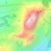
The range starts near south of the Tapti river and runs approximately 1,600 km (990 mi) through the states of Gujarat, Maharashtra, Karnataka, Goa, Kerala and Tamil Nadu ending at Marunthuvazh Malai, Swamithope near the southern tip of India. These hills cover 160,000 km2 (62,000 sq mi) and form the catchment…
Altitud media: 2.225 m
Shimla
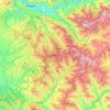
Shimla is on the south-western ranges of the Himalayas at 31°37′N 77°06′E / 31.61°N 77.10°E / 31.61; 77.10. It has an average altitude of 2,206 metres (7,238 ft) above mean sea level and extends along a ridge with seven spurs. The city stretches nearly 9.2 kilometres (5.7 mi) from east to west.
Altitud media: 1.557 m

Madikeri
India > Karnataka > Madikeri taluku
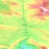
Madikeri features a tropical highland climate as it has an elevation of 1,170 m (3,840 ft). Madikeri is located at 12°25′N 75°44′E / 12.42°N 75.73°E / 12.42; 75.73. Madikeri lies in the Western Ghats and is a popular hill station. The nearest cities are Hassan to the north, Mangaluru to the…
Altitud media: 1.054 m
Ranchi
Ranchi lies at 23°22′N 85°20′E / 23.36°N 85.33°E / 23.36; 85.33 near to the Tropic of Cancer. The city covers an area of 175 km2 (68 sq mi) and its average elevation is 651 m above sea level. Ranchi is located in the southern part of the Chota Nagpur plateau, which is the eastern section of…
Altitud media: 648 m




Araku Valley
India > Andhra Pradesh > Araku Valley
Araku is located in the Eastern Ghats about 114 kilometres (71 mi) from Visakhapatnam, close to the Odisha state border. The Anantagiri and Sunkarimetta Reserved Forest, which are part of Araku Valley, are rich in biodiversity and are mined for bauxite. Galikonda hill rising to a height of 5,000 feet (1,500 m)…
Altitud media: 976 m

Chennai
Chennai is located on the south–eastern coast of India in the north–eastern part of Tamil Nadu on a flat coastal plain known as the Eastern Coastal Plains. Its average elevation is around 6.7 metres (22 ft), and its highest point is 60 m (200 ft). Chennai is 2,184 kilometres (1,357 mi) south of Delhi,…
Altitud media: 7 m

Maharashtra
Maharashtra is the third largest state by area in India. The Western Ghats better known as Sahyadri, are a hilly range running parallel to the coast, at an average elevation of 1,200 metres (4,000 ft). Kalsubai, a peak in the Sahyadris, near Nashik city is the highest elevated point in Maharashtra. To the west…
Altitud media: 478 m


Panvel
India > Maharashtra > Panvel > Panvel
Matheran is a hill station and a municipal council in the Raigad district in the Indian state of Maharashtra. It is a hill station in Karjat Tahsil and is also the smallest hill station in India. It is located on the Western Ghats range at an elevation of around 800 m (2,625 feet) above sea level. It is…
Altitud media: 75 m


Mangaluru
India > Karnataka > Mangaluru taluk
Mangalore is also the administrative headquarters of the Dakshina Kannada district; it is a commercial, industrial, educational, healthcare, and startup hub. The city's international airport is the second-largest and second-busiest airport in Karnataka. Mangalore City Corporation is responsible for the civic…
Altitud media: 25 m











Aluva
Aluva Railway Station (IR Code: AWY) is a grade-A railway station in Kerala, and is the third busiest railway station in Kochi after Ernakulam Junction railway station and Ernakulam Town railway station. All passenger and express trains bound to southern Kerala have a stop at it. People travelling from the…
Altitud media: 11 m



Thrippunithura
India > Kerala > Kanayannur
In the south, Thrippunithura borders the Vembanad, the longest lake in India. The lake provides facilities for inland water navigation, with the Champakkara canal stretch of the National Waterway 3 forming its western boundary with Kochi and Maradu. The canal then merges with the Chithrapuzha river in the…
Altitud media: 8 m


Kapadvanj
India > Gujarat > Kapadvanj Taluka
Kapadvanj is located at 23°01′N 73°04′E / 23.02°N 73.07°E / 23.02; 73.07. It has an average elevation of 69 metres (226 feet).
Altitud media: 77 m




Sultan Bathery
India > Kerala > Sulthanbathery
Sulthan Bathery is located at 11°40′N 76°17′E / 11.67°N 76.28°E / 11.67; 76.28. It has an average elevation of 907 m (2,976 ft).
Altitud media: 876 m

Bokaro
Bokaro district consists of undulating uplands on the Chota Nagpur Plateau with the Damodar River cutting a valley right across. It has an average elevation of 200 to 540 metres (660 to 1,770 ft) above mean sea level. The highest hill, Lugu Pahar, rises to a height of 1,070 metres (3,510 ft). The East Bokaro…
Altitud media: 232 m
Amravati
India > Maharashtra > Amravati
Amravati is located at 20°56′N 77°45′E / 20.93°N 77.75°E / 20.93; 77.75. It has an average elevation of 343 meters (1125 feet). It lies 156 km (97 mi) west of Nagpur and serves as the administrative centre of Amravati District and of Amravati Division. The city is located near the passes…
Altitud media: 345 m


Shimla
Shimla is on the south-western ranges of the Himalayas at 31°37′N 77°06′E / 31.61°N 77.10°E / 31.61; 77.10. It has an average altitude of 2,206 metres (7,238 ft) above mean sea level and extends along a ridge with seven spurs. The city stretches nearly 9.2 kilometres (5.7 mi) from east to west.
Altitud media: 1.557 m