
Mapa topográfico Parker City
Mapa interactivo
Haga clic en el mapa para ver la altitud.
Acerca de este mapa
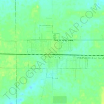
Nombre: Mapa topográfico Parker City, altitud, relieve.
Lugar: Parker City, Randolph County, Indiana, 47368, United States (40.18327 -85.21266 40.19704 -85.19199)
Altitud media: 312 m
Altitud mínima: 304 m
Altitud máxima: 319 m
According to the 2010 census, Parker City has a total area of 0.57 square miles (1.48 km2), all land. It is located at an elevation of 1025 feet.
Otros mapas topográficos
Haga clic en un mapa para ver su topografía, su altitud y su relieve.
Union City
United States > Indiana > Randolph County
Union City, Randolph County, Indiana, United States
Altitud media: 333 m
Windsor
United States > Indiana > Randolph County
Windsor, Randolph County, Indiana, 47368, United States
Altitud media: 312 m
Farmland
United States > Indiana > Randolph County
Farmland, Randolph County, Indiana, United States
Altitud media: 318 m
Lynn
United States > Indiana > Randolph County
Lynn, Randolph County, Indiana, United States
Altitud media: 356 m
Modoc
United States > Indiana > Randolph County
Modoc, Randolph County, Indiana, United States
Altitud media: 355 m
Winchester
United States > Indiana > Randolph County
Winchester, Randolph County, Indiana, 47494, United States
Altitud media: 335 m