
Mapa topográfico Wathlingen
Mapa interactivo
Haga clic en el mapa para ver la altitud.
Acerca de este mapa
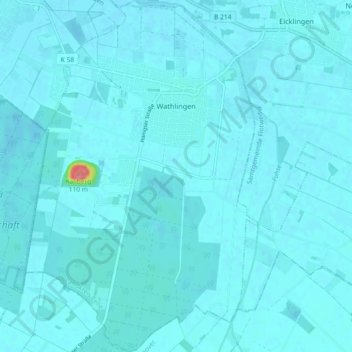
Nombre: Mapa topográfico Wathlingen, altitud, relieve.
Altitud media: 44 m
Altitud mínima: 39 m
Altitud máxima: 131 m
Otros mapas topográficos
Haga clic en un mapa para ver su topografía, su altitud y su relieve.
Celle
Germany > Lower Saxony > Landkreis Celle
Celle, Landkreis Celle, Lower Saxony, Germany
Altitud media: 48 m
Lohheide
Germany > Lower Saxony > Landkreis Celle > Lohheide
Lohheide, Landkreis Celle, Lower Saxony, Germany
Altitud media: 71 m
Faßberg
Germany > Lower Saxony > Landkreis Celle
Faßberg, Landkreis Celle, Lower Saxony, 29328, Germany
Altitud media: 77 m
Klein Hehlen
Germany > Lower Saxony > Landkreis Celle > Celle
Klein Hehlen, Celle, Landkreis Celle, Lower Saxony, Germany
Altitud media: 42 m